Sutjeska National Park
For budget tips & compact place-specific travel info... Download my FREE Budget Fact Sheets. You're welcome.
| Download Steph's SUTJESKA NP Quick Budget Fact Sheet | |
| File Size: | 403 kb |
| File Type: | |
It’s quite the intriguing travel tradition I recently established, even if I say so myself: Climb the highest peak of every country I visit. As I was born in a land where the highest point is 323m above sea level (and parts even below sea level), one could argue that I’m easily impressed… Be that as it may, I don’t think I ever liked a person who’s not struck by the magic of a mountain. As such, Bosnia and Herzegovina is quite the captivating destination for me: flourishing with fresh greenery, cold blue rivers cutting through the wide bushy landscapes, and mountains everywhere you look. Who would have thought? From what I have seen in the month I travelled here, is that the country as a whole could be considered one big national park interrupted by a city or village here and there, but in reality there are only three. Surprisingly so.
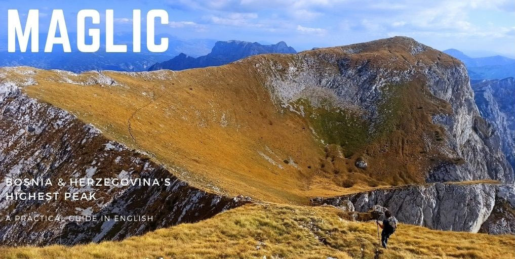
The only southern one, Sutjeska National Park, is both the oldest and biggest, covering a total area of 16,053.24 hectares. It is connected by the Piva, Drina and Neretva rivers and includes Mount Bioč, Vučevo, Maglić, Volujak, Lebršnik and Zelengora. The park includes Perucica, one of Europe’s last remaining and UNESCO-classified primeval forests, meaning that it attained a great age without noteworthy disturbance, keeping its unique ecological features intact. To properly crown it the Mother of National Parks, it also includes the highest peak of entire Bosnia and Herzegovina: Maglić, 2386m. Time to ascend that bad boy.
The only southern one, Sutjeska National Park, is both the oldest and biggest, covering a total area of 16,053.24 hectares. It is connected by the Piva, Drina and Neretva rivers and includes Mount Bioč, Vučevo, Maglić, Volujak, Lebršnik and Zelengora. The park includes Perucica, one of Europe’s last remaining and UNESCO-classified primeval forests, meaning that it attained a great age without noteworthy disturbance, keeping its unique ecological features intact. To properly crown it the Mother of National Parks, it also includes the highest peak of entire Bosnia and Herzegovina: Maglić, 2386m. Time to ascend that bad boy.
Photo by Miles Watson Photography.
Journey & Preparation
As usual, such things are easier said than done, especially when you don’t travel with your own vehicle. First of all, you have to manage getting yourself to Tjentjiste, situated in the bordering valley and the main ‘hub’ of the park (but still a 1-1,5hr car ride away from the main hikes!). Upon checking online, it seemed that there weren’t any actual buses heading there.* So we hitchhiked, which was in our particular case doable and rather quick, yet definitely not something that could be considered a common and widely accepted practice in this country.
* While there, we witnessed bus connections between Trebinje and Sarajevo. There is simply no correct online information to be found, and buses generally come when they come. The most reliable source is simply asking a local, who can estimate a semi-accurate time frame. Buses can be hailed down anywhere, given there is space for the bus to safely pull over.
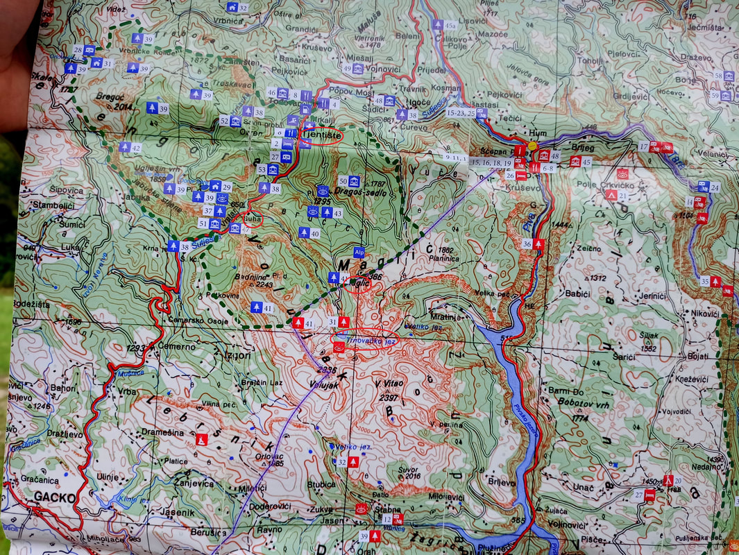
Tjentjiste turned out to be less-than-a-village, with a total of two restaurants and one hidden 2-square-meters-shop which only opens its doors if you call the phone number on the window. In short: Learn from our mistakes and bring supplies and hiking food. Especially if you’re a vegetarian/vegan, which caused me to live on polenta, bread and half-arsed “sopska salata’s” during my entire stay in Sutjeska. Tjentjiste does have a Tourist Info Center, but no one speaks anything else but Bosnian, they have zero information about the park and its hikes, and they only sell the exact same maps you can photograph along the road (or just use the below picture). But no panic, I’m here to help.
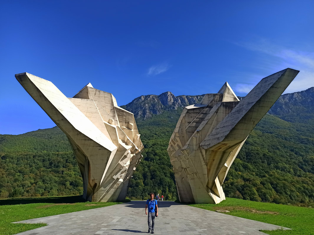
Up: The 2 maps sold by the Info Center… honestly, both equally unhelpful as it doesn’t display the trails. Down: Tjentjiste is the homebase of the Sutjeska Battle Monument. The WWII’s Fifth Offensive, “Operation Schwarz,” was the final and bloodiest struggle that happened here.
Other things to take into account before your arrival:
If you plan to visit the Perucica forest as a separate side-trip, know that it cannot be visited without a guide (allegedly). The guide is paid a flat fee per group, so the more the merrier. Guides have to be booked in advance via the Sutjeska National Park website. Other hikes, incl. the Maglic-hike, don’t include the Perucica forest and therefore can be done without a guide.
In case you don’t come with a vehicle and aren’t comfortable with hitchhiking: Transportation from Tjentjiste up to the hiking start points is offered by most locals for an average KM60 per car. It can be arranged on the spot, but in high season or to assure a hassle-free trip, I advise to arrange this in advance via your booked accommodation.
Climbing Maglic
As dreamy as it may sound, “climbing the highest peak of Bosnia and Herzegovina,” it comes with quite some practical organization. You can’t just put on your hiking boots and climb the damn thing. As usual, that’s exactly what I did though, I tend to pre-plan nothing. Just like you, I was very confused about the different starting points, how to get there and the different trail options… information in English is scarce, and different people say different things. So I learned the hard way and lived to tell the story.
There are two starting points (from Tjentjiste):
- Suha: If you want / have to start from the valley, there is a trail starting from the main road at the parking lot around Suha. If that’s the plan, I recommend staying at Apartmani Sastavci (mediocre quality and food, but friendly people) or at the free, basic Suha Campsite (as marked on Maps.me). I haven’t actually done this trail myself, so I cannot testify the level of difficulty of this stretch… but the ascend towards the Prijevor parking lot is considerable, and that’s where the real ascend is only about to start. It’s a mere 20,5km roundtrip to Maglic, but those kilometres are straaaaaight up (estimated average: 8hrs). As a token for your efforts you will skip on the KM10 park entrance fee, so you’ve got that going for you.
- Prijevor Parking Lot: Most people start up here. However, you either need a vehicle to get there, pay someone KM60 for a roundtrip or take your chances to hitchhike there. We did the latter, which caused some delays and therefore shortened our hiking time. It’s a rather short, yet pretty miserable dirt road up there, which therefore will take about 1-1,5 hrs of your time. You’ll pass the Perucica forest entrance, as well as the park entry ticket booth where you have to pay KM10 per person.
|
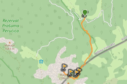
Suha Trail Start
|
Prijevor Trail Start
|
There are three routes towards Maglic:
- The Alpine Route: Due to our lack of time, we figured this would be the shortest way up. It sure is. I was a tiny bit puzzled when my navigation app mentioned a 2km distance, but mentioned a 2hr walking time. That must be a mistake, right? No it’s not. And you’re not walking either… you’re climbing, with hand and feet, sliding passed the steep rocks along crackling cables. As an experienced hiker I found it pretty hardcore, yet fun and adventurous… but if you’re not unfamiliar with vertigo or doubt your level of fitness, then this is definitely a big no-go. Alpine equipment such as harnesses and helmets are recommended, but it is possible without. I advise to only use this trail to ascend, so you face forward and can see where to place your feet… going down, often backwards, will be a guaranteed nightmare.
- The Lake Route: Most people combine the Maglic trail with the Trnovacko Jezero lake, located in Montenegro. The lake trail is mellow and relatively flat, but starts to incline when ascending towards Maglic, be it more gradual and bearable. I recommend walking the Alpine Route up, and the lake route down. When on top of Maglic, you can see the trail in front of you, eventually splitting up… take the right and walk the Lake Route down. Start in the morning to allow sufficient time.
- The Backside Route: There’s a third route connecting to the Maglic peak, creeping up from the backside. We took this route down, as we were slightly stressed for time and didn’t have a vehicle parked on the Prijevor Parking Lot (allowing us to hitchhike down the main road, instead of having to walk all the way back to the parking lot). It’s considered the “easier way,” but I would definitely not underestimate it. The stretch connected to the Maglic peak is pretty damn steep, and also here cables are provided to facilitate the climb. That said, it’s not even remotely comparable to the level of difficulty of the Alpine Route, and especially going up it makes for a more gradual ascend. It’s a stunning stretch through the backland and although without a lakeview definitely not lacking astounding views. However, there’s one big downside: it does not connect with the Prijevor Parking Lot… So if you parked there, you either have to walk five long kilometres over a boring dirt road made for cars, or you have to hitch a ride back, which is pretty hard at the end of the day as traffic drives into the other direction at this time of the day, back to Tjentjiste.
|
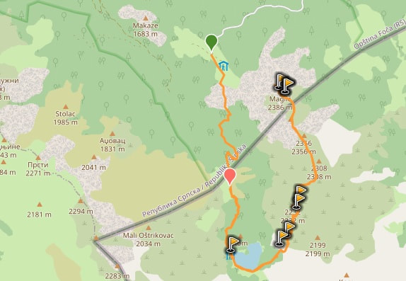
Alpine Route on Wikiloc (in combo with lake route)
|
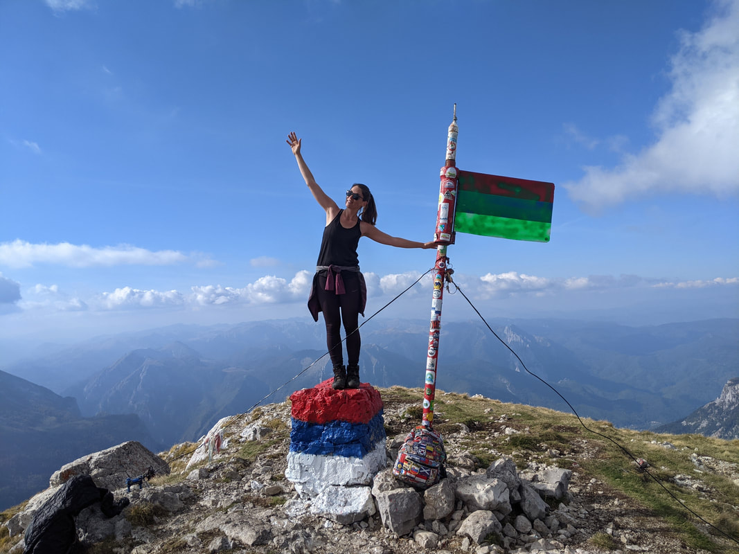
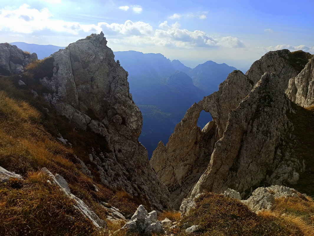
Whatever combination you choose, lavish valleys, forested extents and high elevation mountain meadows will be the main ingredients. No matter how intense the muscles burn or how many deep breaths you needed to take when trying not to look down too often… it’ll be worth it. Standing there, right on the Bosnian-Montenegrin border, absorbing the far panoramas of both of these marvellous destinations, you’ll feel Queen/King of the Balkan if only for a second. This is why you hike.
Whatever combination you choose, lavish valleys, forested extents and high elevation mountain meadows will be the main ingredients. No matter how intense the muscles burn or how many deep breaths you needed to take when trying not to look down too often… it’ll be worth it. Standing there, right on the Bosnian-Montenegrin border, absorbing the far panoramas of both of these marvellous destinations, you’ll feel Queen/King of the Balkan if only for a second. This is why you hike.
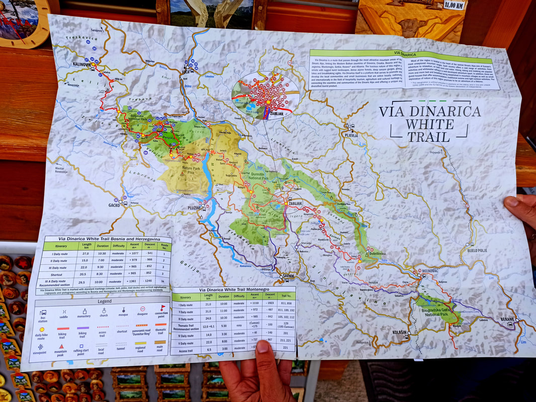
Seed planted? Take it to the next level! The trail you just hiked forms part of the Via Dinarica crossing Slovenia, Croatia, Bosnia and Herzegovina, Montenegro, Kosovo, Albania and Macedonia. It consists of the Green, Blue, and White trail, the latter being 1261km.
In order to support the travelers’ community, I spend many hours per week to adequately document all information and advices for prospective visitors, accompanied by a (hopefully) entertaining insight into my personal observations and experiences. This service is and will remain free. However, if you voluntarily want to make a contribution and support my travels and thus the creation of new stories and information supply, here is the button you’re looking for:
Related:
- Read more about Bosnia & Herzegovina: Mostar, Blagaj, Trebinje, Sarajevo, Jajce, Banja Luka.
- Visit Balkan's finest: Montenegro's National Parks Blog, Kotor Bay & Lovcen NP and Cetinje, Durmitor NP, Podgorica, Prokletije NP and Montenegro's Coastal Towns Blog
- Discover England: Bath, Brighton, Isle of Wight, Portsmouth and London!
- Go Green, Go Scotland: Easdale, Edinburgh, Glasgow, Glencoe / The Highlands and Isle of Skye
- Unravel the mysteries of Serbia
- Get your Albania itinerary ready: Berat, Gjirokastër, Korcë / Ohrid Lake, Theth, Shkodër, Tirana, Mount Korab & the coast!
- Visit Europe's mini-countries: Gibraltar, Liechtenstein, Luxemburg, Kosovo & Wales!
- Europe's best skiing & hiking: Get your ass over to jaw-dropping Switzerland!
- The best hiking destinations of Armenia: Mount Aragats, Dilijan and the southern Legend's (Transcaucasian) Trail
- Be about Bulgaria: Check off Bansko, Belogradchik, Plovdiv, Sofia and of course Veliko Tarnovo!
- Citytripping in Denmark's capital: Copenhagen
- Archeological treasures, UNESCO sights and Greece's roughest nature: Explore the Peloponnese!
- 8 ways to save money in Vienna, Austria
- Spanish citytrips: Barcelona, Malaga & Sevilla
- German gems: Aachen & Frankfurt am Main
- Destinations of Hungary: Balaton Lake, Budapest and Szekesfehervar
- Hiking Poland's longest mountain trail (550km) with a tent: Glowny Szlak Beskidzki - check the reports here!
- Walk like a pilgrim! 6 weeks on the Camino Frances towards Santiago de Compostela / Finisterre (900km) - check the reports here!
