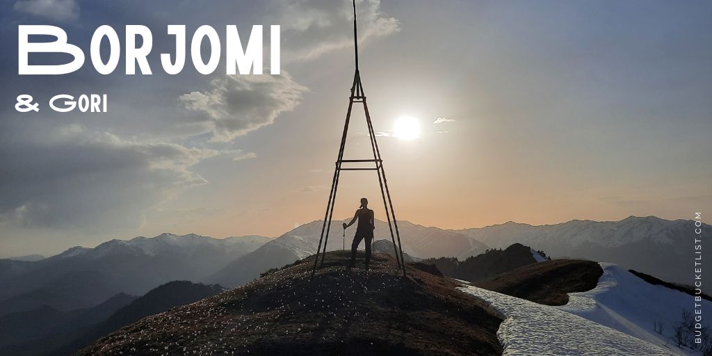
Borjomi & Gori
Not in the story-mood? Scroll down for the Quick Budget Fact Overview: an itemized information summary of Borjomi and Gori! ↓
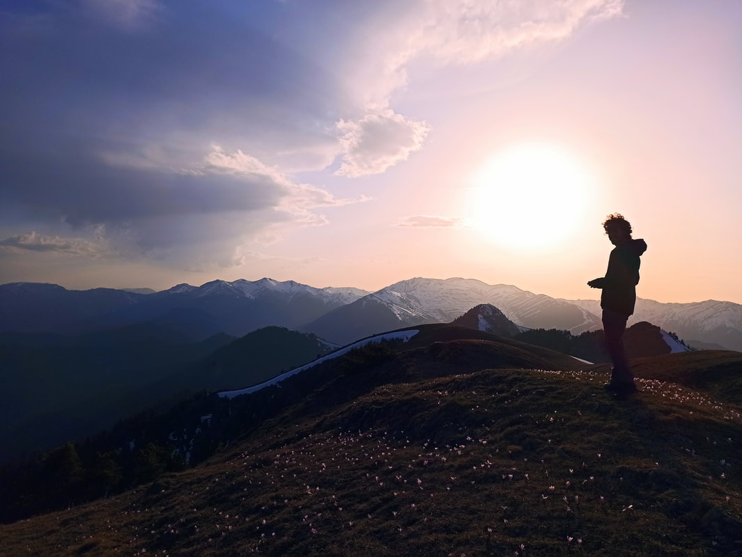
The main draw of Georgia is (in my humble opinion) the richness in natural treasures. Its lion share is immersed in the almighty Caucasus, while the different areas of interest are subdivided in a high number of national parks.* The biggest one of all? The Borjomi-Kharagauli National Park, covering no less than 85,083 hectares! To put this size into perspective: The area traverses three different regions and six municipalities, and the park takes up more than 1% of the entire country. Whoof! Even though you shouldn’t expect to find the dramatic peaks like those of Kazbegi or Svaneti, this national park situated in the “Lesser Caucasus” still offers mountains up to 2642m in height, embellished by extended subalpine meadows, relict flora and fauna species, as well as virgin forest land. In fact, during my first visit to Georgia halfway-May it were exactly these lower elevations that invited for a visit: Whereas the Higher Caucasus was still covered in a thick layer of snow, requiring special tools and equipment for even the most straightforward hikes, Borjomi was already perfectly accessible for some early springtime strolls!
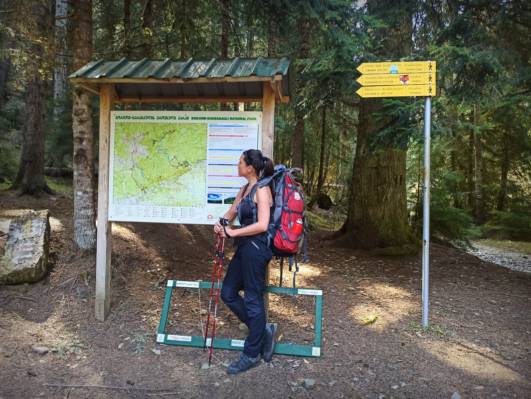
Due to the sheer size of this national park, there are two main entrances and visitor centres forming the gateway to the main treks: One in Borjomi and one in Kharagauli (the name already gives it away!). Even though Kharagauli is most easily accessible, located at a 1-hour drive from Kutaisi, Borjomi is a more popular base of exploration. I guess the idyllic location right inside the national park, as well as its healing mineral waters have something to do with it!
Due to the sheer size of this national park, there are two main entrances and visitor centres forming the gateway to the main treks: One in Borjomi and one in Kharagauli (the name already gives it away!). Even though Kharagauli is most easily accessible, located at a 1-hour drive from Kutaisi, Borjomi is a more popular base of exploration. I guess the idyllic location right inside the national park, as well as its healing mineral waters have something to do with it!

* At the time of writing including: Borjomi-Kharagauli; Kolkheti; Tusheti; Vashlovani / Chachuna; Lagodekhi; Mtirala; Algeti; Kazbegi; Tbilisi; Javakheti; Marchaklhela; Kintrishi; Kobuleti; and Pshav-Khevsureti National Park.
Hiking in Borjomi
“The tourist season lasts all year, allowing visitors to experience the stunning variety of flora and fauna [..] as well as a broad network of 12 trails through the ancient woodlands”, screams the Borjomi-Kharagauli National Park website. Alright, let me start off with banishing that statement to the Land of Bullshit. As mentioned earlier, my visit took place halfway-May, when most of the snow had already melted off Borjomi’s modest-sized peaks. I had therefore planned in almost a week to systematically check off all of those 12 routes that were so boldly advertised. You can imagine my disappointment when the park ranger at the Visitor Centre informed me that only 3 trails were ready to receive its first hikers, the others still being covered in fallen tree trunks and remnants of landslides. I fully understand the complexity and labor-intensity of the admirable work carried out by the rangers and volunteers when it comes to clearing the trails for us to freely enjoy… but to claim that the trail-network is up and running all year round is simply not true.
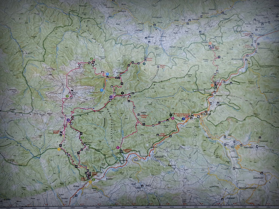
In theory, this is Borjomi-Kharagauli’s trail network:
Hiking in Borjomi
“The tourist season lasts all year, allowing visitors to experience the stunning variety of flora and fauna [..] as well as a broad network of 12 trails through the ancient woodlands”, screams the Borjomi-Kharagauli National Park website. Alright, let me start off with banishing that statement to the Land of Bullshit. As mentioned earlier, my visit took place halfway-May, when most of the snow had already melted off Borjomi’s modest-sized peaks. I had therefore planned in almost a week to systematically check off all of those 12 routes that were so boldly advertised. You can imagine my disappointment when the park ranger at the Visitor Centre informed me that only 3 trails were ready to receive its first hikers, the others still being covered in fallen tree trunks and remnants of landslides. I fully understand the complexity and labor-intensity of the admirable work carried out by the rangers and volunteers when it comes to clearing the trails for us to freely enjoy… but to claim that the trail-network is up and running all year round is simply not true.
In theory, this is Borjomi-Kharagauli’s trail network:
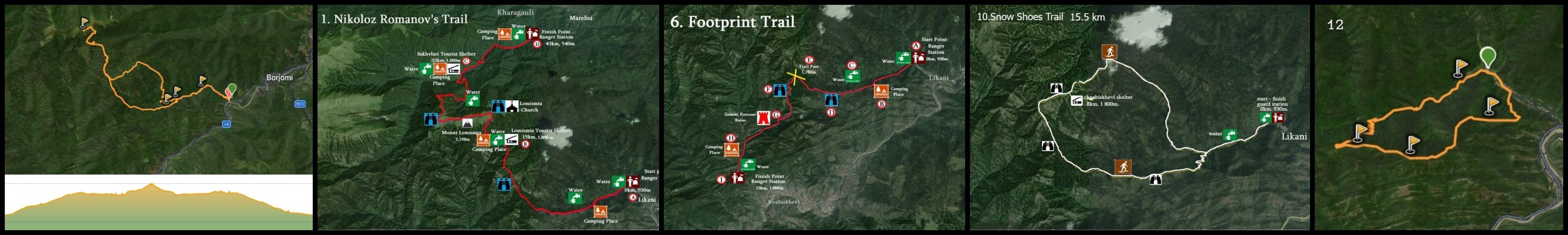
However, at the time only Trail 10 and 12 and small sections of Trail 1 and 6 from Likani up until the Lomitsma Peak were accessible. Alright, that settles it then: As most of these trails are partly overlapping, I grabbed the opportunity to squeeze it all into one magnificent trek!
[Keep in mind that levels of difficulty are very personal. What is difficult for the standard tourist who hardly ever hikes, is a “walk in the park” for a seasoned trekker. I’m a trained and regular hiker, acquainted with mountainous conditions, and as such I qualify relatively flat hikes with pleasant, even trails as “easy”. Every person in decent health should be able to do these, and to fervent hikers they don’t represent a challenge. “Intermediate” hikes include some more demanding and steep stretches and are generally of a decent distance, making it suitable for relatively fit people who hike regularly, with a pleasant challenge here and there. Untrained hikers might regard these intermediate hikes as demanding. “Difficult” hikes involve technical ascends and descends, potential uneven and challenging terrain requiring upper concentration (incl. potential off-trail sections), as well as considerable distances (25-40km for a day trip). “Advanced” hikes require excellent mountaineering and navigation skills, special equipment and potentially a mountain guide.]
Lomitsma Peak 2-Day Loop (trail 1-6-10-12 combo)
Distance: 36km.
Elevation Gain: 1907m. Highest point: Lomitsma Peak.
Level of Difficulty: Intermediate.
Starting Point: Likani (can be reached by mashrutka). Keep in mind that from the highway turnoff you still have to walk a couple of kilometres on asphalt road to reach the trailhead, which is included in the 36km.
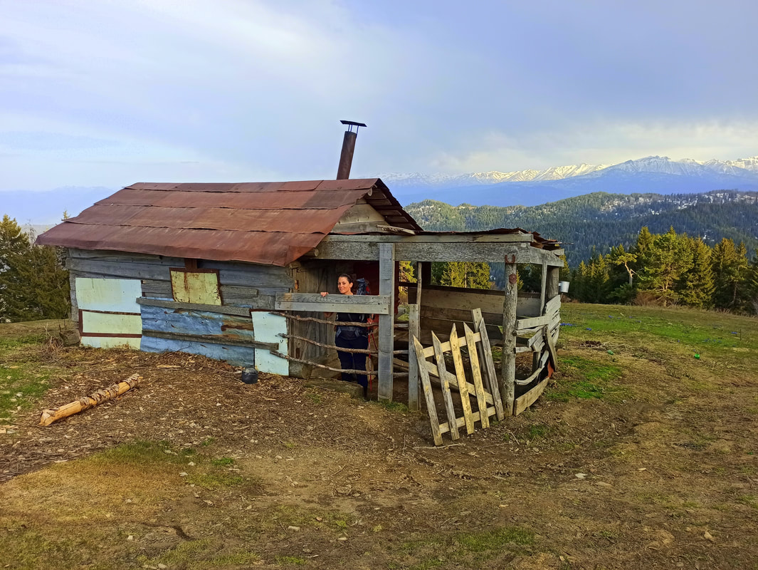
Huts / Campsite: Lomitsma Hut / Campsite. There’s a water source available at the trail head and the hut.
Even though the ranger kept insisting this is a 3-day hike, a closer look at the distance and elevation made me severely doubt that: 36km, 1907m… hmm… that should be 2 days tops, and relatively mellow ones at that! Not sure if after my winter-period of hiking-hibernation I didn’t quite look like the beacon of fitness I fancy myself to be (more like the “bacon” of fitness), or if the majority of the Borjomi-visitors just doesn’t go all out when hitting the trails… but 2 days is more than enough to complete this pleasant, yet at times unforgivingly steep mountainside trek. If you only intend to go as far as the Lomitsma Hut, you can even make it a daytrip.
As usual, I had a bit of a late start. I belong to that 1% of the hiker-population that doesn’t rise before dawn, I simply don’t have it in me (which is usually rewarded with delightfully empty trails, so I have zero intentions to break that habit). Even though mashrutka’s leave into the direction of Likani, I was too lazy to talk to the drivers and figure it all out, so I simply put up my thumb for an easy hitchhike to the turn-off. The necessary asphalt-stretch to reach the trailhead aside, the first few kilometres of the path, forming a part of Trail 1, 10, 12* as well as Trail 6, are as heavenly as you imagine any lush forest hike to be. A mellow intro to smoothen you up for the rest of the hike, making you believe it’s going to be an easy one… *Negative buzzer sound*: Once you reached the split off** be ready to climb upwards all the way until the Lomitsma Peak, without too many flat stretches allowing for a well-desired relief.
* A part of Trail 12 kicks off a bit before the official trail head where Trail 1, 10, 6 and 12 overlap. It’s located on the left side when walking from the highway towards the trail head. If you start here and connect to the trail leading up to the Lomitsma Hut, and on the way back down take the right side of Trail 10, you can avoid backtracking of a trail-stretch you already walked before. However, I was unable to find the start of Trail 12 (I could only see the split-off higher up).
** I went left at the split-off onto Trail 1-6-10, thinking it was the shortest way up. However, the map is truly deceiving! Even though it is in fact a tad shorter than the trail on the right side (part of Trail 10), there are more curves involved than the line can indicate. Combined with the steepness this is not an easy route!
[Keep in mind that levels of difficulty are very personal. What is difficult for the standard tourist who hardly ever hikes, is a “walk in the park” for a seasoned trekker. I’m a trained and regular hiker, acquainted with mountainous conditions, and as such I qualify relatively flat hikes with pleasant, even trails as “easy”. Every person in decent health should be able to do these, and to fervent hikers they don’t represent a challenge. “Intermediate” hikes include some more demanding and steep stretches and are generally of a decent distance, making it suitable for relatively fit people who hike regularly, with a pleasant challenge here and there. Untrained hikers might regard these intermediate hikes as demanding. “Difficult” hikes involve technical ascends and descends, potential uneven and challenging terrain requiring upper concentration (incl. potential off-trail sections), as well as considerable distances (25-40km for a day trip). “Advanced” hikes require excellent mountaineering and navigation skills, special equipment and potentially a mountain guide.]
Lomitsma Peak 2-Day Loop (trail 1-6-10-12 combo)
Distance: 36km.
Elevation Gain: 1907m. Highest point: Lomitsma Peak.
Level of Difficulty: Intermediate.
Starting Point: Likani (can be reached by mashrutka). Keep in mind that from the highway turnoff you still have to walk a couple of kilometres on asphalt road to reach the trailhead, which is included in the 36km.
Huts / Campsite: Lomitsma Hut / Campsite. There’s a water source available at the trail head and the hut.
Even though the ranger kept insisting this is a 3-day hike, a closer look at the distance and elevation made me severely doubt that: 36km, 1907m… hmm… that should be 2 days tops, and relatively mellow ones at that! Not sure if after my winter-period of hiking-hibernation I didn’t quite look like the beacon of fitness I fancy myself to be (more like the “bacon” of fitness), or if the majority of the Borjomi-visitors just doesn’t go all out when hitting the trails… but 2 days is more than enough to complete this pleasant, yet at times unforgivingly steep mountainside trek. If you only intend to go as far as the Lomitsma Hut, you can even make it a daytrip.
As usual, I had a bit of a late start. I belong to that 1% of the hiker-population that doesn’t rise before dawn, I simply don’t have it in me (which is usually rewarded with delightfully empty trails, so I have zero intentions to break that habit). Even though mashrutka’s leave into the direction of Likani, I was too lazy to talk to the drivers and figure it all out, so I simply put up my thumb for an easy hitchhike to the turn-off. The necessary asphalt-stretch to reach the trailhead aside, the first few kilometres of the path, forming a part of Trail 1, 10, 12* as well as Trail 6, are as heavenly as you imagine any lush forest hike to be. A mellow intro to smoothen you up for the rest of the hike, making you believe it’s going to be an easy one… *Negative buzzer sound*: Once you reached the split off** be ready to climb upwards all the way until the Lomitsma Peak, without too many flat stretches allowing for a well-desired relief.
* A part of Trail 12 kicks off a bit before the official trail head where Trail 1, 10, 6 and 12 overlap. It’s located on the left side when walking from the highway towards the trail head. If you start here and connect to the trail leading up to the Lomitsma Hut, and on the way back down take the right side of Trail 10, you can avoid backtracking of a trail-stretch you already walked before. However, I was unable to find the start of Trail 12 (I could only see the split-off higher up).
** I went left at the split-off onto Trail 1-6-10, thinking it was the shortest way up. However, the map is truly deceiving! Even though it is in fact a tad shorter than the trail on the right side (part of Trail 10), there are more curves involved than the line can indicate. Combined with the steepness this is not an easy route!
That said, the clearly signposted trail is very comfortable and allows for easy navigation. Where during some hikes I have to constantly focus on my foot placement to prevent my clumsy ass from stumbling my way across the trail, this route has a pleasantly flat and level surface area actually allowing you to look around you and take in the divine environment. However much I love the serenity (and shade!) of the forest, that looking-around-part I just mentioned will be most rewarding once you climbed your way up above the tree line from where you’ll be granted a sublime sequence of far-reaching panoramas.
I was only 3,5 hours on the move when the Lomitsma Hut already appeared into eyesight. I knew it, those by the Visitor’s Centre predicted 5-6hrs serve as just some “worst case scenario” kinda-deal, to not let the most-unfit among us arrive far after midnight (or feel too bad about themselves). As such, I had plenty of time to set up my tent, replenish my water supplies and head up the Lomitsma Peak without having to carry a heavy backpack full of food and camping gear. Quite gratefully so! I thought that after the previous 15km I got a slight grasp of what a “steep trail” feels like after a few months of relative inactivity (I mean – the laidback hikes in Cyprus don’t really count), but this last hut-to-peak-stretch forced me to face the facts again. Burning calves included! Yet, you’re in it to win it… the last section, formed by a kaleidoscopic wildflower-carpet hazily unrolling towards the peak, is what sweet dreams are made of. If they ever make a documentary about my life, then this scene should be in it.
I had only just arrived in Georgia and hadn’t even seen the High Caucasus yet, but I was already swept off my feet before I could properly get my head around it! This thought rolled from my lips in the form of a toast (a strong Georgian tradition), while I raised my glass to the welcoming family I just met and who had generously shared the ample food- and alcohol supply they had somehow dragged up that mountain on this sunny Easter weekend. I was promptly challenged by the dad to bump one red-painted egg (portraying the blood shed by Christ) against the other… his broke, mine stayed intact: This means I have a fortunate year ahead, at least until the next Orthodox Easter celebration!
Indeed, it couldn’t have started any better.
The first photo of the series covers my combined trail. Find the GPS details here. Water sources are marked on the recording.
Even though unfortunately not all trails were available during my visit, I will provide you with the details of each trail. It is possible to mix and match, as some trails overlap or are in close proximity of one another. It’s possible to camp around the huts:
Trail 1: Nikolay Romanov Trail
Distance: 43km. Find the GPS recording here!
Elevation Gain: 1907m. Highest point: Lomitsma Peak.
Level of Difficulty: Intermediate.
Starting Point: Likani (can be reached by mashrutka). Keep in mind that from the highway turnoff you still have to walk a couple of kilometres on asphalt road to reach the trailhead.
Huts / Campsite: Lomitsma Hut / Sakhvlari Hut / Likani Campsite.
Trail 2: St. Andrews Trail
Distance: 54km. Find the GPS recording here!
Elevation Gain: 3329m. Highest point: Sametskhvario Peak.
Level of Difficulty: Intermediate – Difficult. Allegedly the most difficult one, taking 3-4 days.
Starting Point: Atskuri Ranger Station.
Huts / Campsite: Amarati Hut / Samet Skhvario Hut / Sakhvlari Hut / Kvasvinevi Shelter.
Trail 3: Panorama Trail
Distance: 34km. Find the GPS recording here!
Elevation Gain: 2570m.
Level of Difficulty: Easy - Intermediate.
Starting Point: Atskuri Ranger Station.
Huts / Campsite: Amarati Hut.
Trail 4: Pure Pristine Forest Trail
Distance: 13km. Find the GPS recording here!
Elevation Gain: 978m.
Level of Difficulty: Easy - Intermediate.
Starting Point: Zanavi Ranger Station.
Huts / Campsite: Nunisi Ranger Station.
Trail 5: Zekari Pass (also a bicycle trail)
Distance: 31km. Find the GPS recording here!
Elevation Gain: 1367m.
Level of Difficulty: Easy - Intermediate.
Starting Point: Abastumani Ranger Station.
Huts / Campsite: Didmagala Hut.
Trail 6: Following Wildlife Traces Trail
Distance: 13km. Find the GPS recording here!
Elevation Gain: 1092m.
Level of Difficulty: Intermediate.
Starting Point: Likani (can be reached by mashrutka). Keep in mind that from the highway turnoff you still have to walk a couple of kilometres on asphalt road to reach the trailhead..
Huts / Campsite: Likani Campsite / Kvabiskhevi Ranger Station.
Trail 7: National Park Info Trail
Distance: 3km. Find the GPS recording here and here!
Elevation Gain: Highest Peak: 950m.
Level of Difficulty: Easy.
Starting Point: National Park Visitor Centre.
Huts / Campsite: N/A.
Trail 8: Mergruki Gorge
Distance: 5.5km (1-way).
Level of Difficulty: Intermediate.
Starting Point: Sakhvlari Tourist Shelter (reached by trail #1 or #2).
Huts / Campsite: Sakhvlari Tourist Shelter.
Trail 9: Shepherds Trail
Distance: 23km. Links Trail #1 and #2.
Level of Difficulty: Intermediate.
Starting Point: Likani (can be reached by mashrutka), following trail #1. Keep in mind that from the highway turnoff you still have to walk a couple of kilometres on asphalt road to reach the trailhead.
Huts / Campsite: Likani Campsite / Lomitsma Hut / Amarati Hut.
Trail 10: Snowshoe Trail
Distance: 15.5km. Find the GPS recording here!
Elevation Gain: 1124m.
Level of Difficulty: Intermediate.
Starting Point: Likani (can be reached by mashrutka), following trail #1. Keep in mind that from the highway turnoff you still have to walk a couple of kilometres on asphalt road to reach the trailhead.
Huts / Campsite: Likani Campsite / Chitakhevi Hut (no water).
Trail 11: Snowshoe Trail
Distance: 6km (1-way). Find the GPS recording here!
Elevation Gain: 995m.
Level of Difficulty: Intermediate.
Starting Point: Atskuri Ranger Station.
Huts / Campsite: N/A.
Trail 12: Likani Gorge Trail
Distance: 7km.
Elevation Gain: 995m.
Level of Difficulty: Intermediate.
Starting Point: Likani (can be reached by mashrutka), following trail #1. Keep in mind that from the highway turnoff you still have to walk a couple of kilometres on asphalt road to reach the trailhead.
Huts / Campsite: N/A.
Good to know:
- There is no entrance fee for the Borjomi-Kharagauli National Park (anno 2022-2023). However, camping out or spending the night in the hut is possible at a small fee.
- You have to register at the Visitor Centre before initiating any hike and pay potential camping/hut fees in advance. Personally, I wasn’t checked, but I met people who mid-hike were sent back to register, which is something you 100% want to avoid. This registration is free of charge.
- The huts are very basic shelters and don’t have showers or cooking facilities. You also need to bring your own mat and sleeping bag. No-frills hole-in-the-ground toilets are usually available.
- The Visitor Centre in Borjomi rents out sleeping bags and some hiking gear for rather low prices (this isn’t the case at all national parks). However, the sleeping bags are crap: too thin and of low quality. I recommend bringing your own gear, or renting it in advance in Tbilisi (for example at Mplus).
- Water is available in the valley and at most huts (not all!), but not always along the way. The availability also depends on the season. Verify the water situation upon your registration at the Visitor Centre, and always bring more water than you need and replenish at every opportunity possible. It’s of crucial importance during any hike.
Other Things to Do in Borjomi
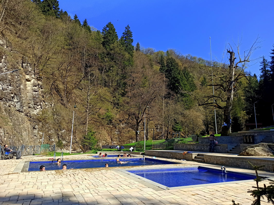
Borjomi got famous for 2 reasons: Its national park and its mineral water. If you have been traveling through Georgia for a fair bit, you might have spotted the name on a bottle on some occasions. That’s right, Borjomi is the “Spa” or “Bar-le-Duc” of the country. It’s hydrogen-sulphide thermal springs can reach a natural temperature of up to 30-32 degrees and it’s believed to possess some magical curing features, which used to be reserved for the fancy members of high society. Nowadays, simple folks like us have access to it as well, in exchange for a small entry fee to the Central City Park* plus an extra fee for the baths** (mind you: as there’s a hyperinflation going on in Georgia, I refrain of quoting exact rates). Personally, I prefer bathing in it far over drinking the stuff. If you wonder why, I warm-heartedly invite you to have a sip of that foul, hot, fart-smelling liquid… physical well-being, fair enough, but what about our mental well-being?
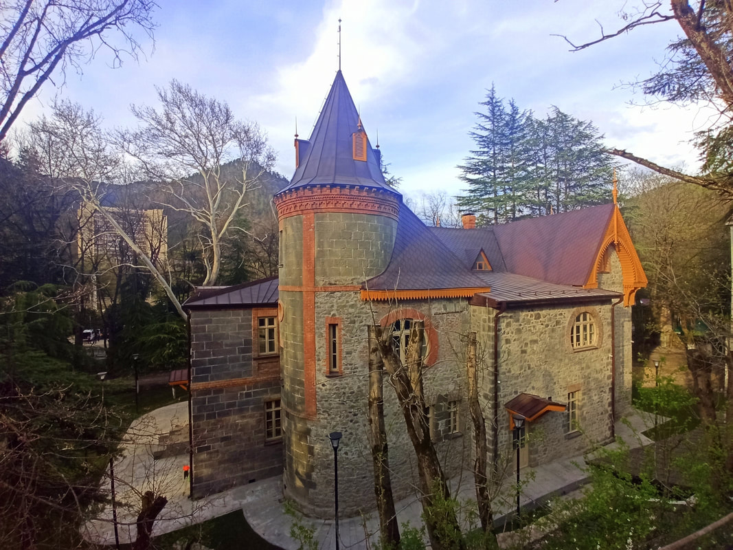
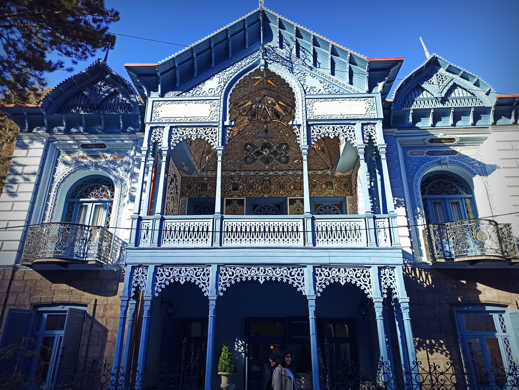
Besides that, you can shoot some holiday shots at the Firuza Cultural Heritage Monument (fancy name for a picture-friendly traditional house) and the Local Lore Museum which was closed on every day I was there, even though the sign said it should technically be open.
* It’s some kind of low-key fun fair with kid’s attractions and the standard ferris wheel Georgians love so much.
** Walk to the end of the park until it turns into a trail. There’s no signage anywhere, but just keep walking! It’s about 2km more. There’s an upper trail to return, so you can make it into a laidback loop without having to pay for the cable car to get the views.
Borjomi got famous for 2 reasons: Its national park and its mineral water. If you have been traveling through Georgia for a fair bit, you might have spotted the name on a bottle on some occasions. That’s right, Borjomi is the “Spa” or “Bar-le-Duc” of the country. It’s hydrogen-sulphide thermal springs can reach a natural temperature of up to 30-32 degrees and it’s believed to possess some magical curing features, which used to be reserved for the fancy members of high society. Nowadays, simple folks like us have access to it as well, in exchange for a small entry fee to the Central City Park* plus an extra fee for the baths** (mind you: as there’s a hyperinflation going on in Georgia, I refrain of quoting exact rates). Personally, I prefer bathing in it far over drinking the stuff. If you wonder why, I warm-heartedly invite you to have a sip of that foul, hot, fart-smelling liquid… physical well-being, fair enough, but what about our mental well-being?
Besides that, you can shoot some holiday shots at the Firuza Cultural Heritage Monument (fancy name for a picture-friendly traditional house) and the Local Lore Museum which was closed on every day I was there, even though the sign said it should technically be open.
* It’s some kind of low-key fun fair with kid’s attractions and the standard ferris wheel Georgians love so much.
** Walk to the end of the park until it turns into a trail. There’s no signage anywhere, but just keep walking! It’s about 2km more. There’s an upper trail to return, so you can make it into a laidback loop without having to pay for the cable car to get the views.
In the Area
Bakuriani
Are you visiting Borjomi in the winter season? While the trails might be inaccessible except of the snowshoe-routes (scroll up), the mountain resort of Bakuriani offers some alternative fun on the hillsides. Situated in the Didveli region, some 29km away from Borjomi, this ski and snowboard destination offers 4-5 months of snow adventures on a 1700m elevation. They even claim their 14km of slopes are meeting “Olympic standards”… you might as well have a look to verify that bold statement. In summer, the slopes make place for some pleasant hiking opportunities, while the “Kakushka Train” attracts a broader scope of tourists.*
* During my visit, this train was not operational. The finger was pointed at COVID, even though I haven’t seen a single mask or otherwise concerned citizen during my 2 months of visiting this country.
Abustamani
If you could appreciate the healing qualities of Borjomi’s thermal baths, you might want to consider a stopover at the neighbouring spa town Abustamani as well. The town is home to wellness tourism and sanatoria concentrated on its 3 sulfate-sodium chloride rich baths, which historically played an important role in the treatment of tuberculosis. Hiking trail 5, traversing the Zekari Pass, kicks off at Abustamani.
Gori
Gori’s main claim to fame, milked to the very last drop, is being the birthplace of Joseph Stalin. Yeah, I had no idea he was born in Georgia either, so no shame in that. While this is an ambiguous status, pleasing some and enraging others, we can’t deny this being the main reason for tourists to come over (incl. you and me). It is, after all, a man who pressed an eternal mark on the Soviet’s and world’s history. The main attraction of this dark tourism endeavour? The Stalin Museum, a fun day out for the entire family! While it’s rather overpriced for what it is and about as cheerful as you can expect from a homage to a dictator / mass murderer, it is in fact quite interesting to enter his humble birth house as well as his swanky private train compartment. Make sure to have some data on your phone and install the Google Lens app for translations, as the info boards are just in Georgian and Russian.
“Man is not eternal. And I will die. What will be the judgment of the people and history? There were many mistakes, but there were also achievements. Errors, of course, will be attributed to me. A heap of garbage will be put on my grave, but the day will come and the wind of history will mercilessly dispel it.” – Joseph Stalin, referring to a day that has yet to come.
Uplistsikhe & Vardzia Cave Towns
Besides an ample supply in mountains, vineyards and historical towns, “ancient cave towns” is another Georgian specialty. Borjomi is in the relative proximity of two, namely Vardzia and Uplistsikhe. The first one is said to be completed during the reign of Queen Tamar, who screamed “Ak Var, Dzia” (“I’m here, uncle”) after being lost in the countless labyrinths of this extensive cave network. The cave town was known for its luxury, comprising around 3000 rooms serving for example as sleeping and living quarters, as well as treasuries shops and pharmacies. Unfortunately, visiting isn’t too easy without your own vehicle: You must take a mashrutka to Akhaltsikhe, from where you have to change into another one operating only thrice a day: 10:40AM and 1:30PM, returning at 3PM… availability not guaranteed. Tours are available, generally unlicensed and offered by random taxi drivers on the streets of Borjomi or Tbilisi… however, this isn’t a cheap option.
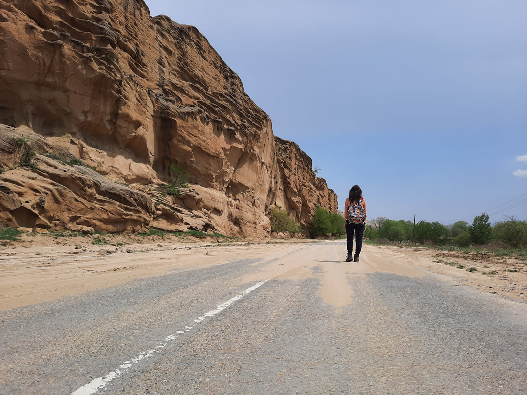
Alternatively, you can visit Uplistsikhe, which is only 10km east of Gori (there is supposedly a mashrutka operating on an irregular basis, but during my visit I haven’t seen it – I hitchhiked). It’s said to be the oldest cave town of all, dating back to the Ice Age. Over the years it evolved to be an important political and religious centre, as well as a strategic trading post. The visitors area of present-day Uplistsikhe takes up a fraction of the original town, allowing access to the inner city area. Combined with the stunning surroundings, encompassing the planned national park of Trialeti, this daytrip by far tops the experience of all attractions of Gori combined.
Besides an ample supply in mountains, vineyards and historical towns, “ancient cave towns” is another Georgian specialty. Borjomi is in the relative proximity of two, namely Vardzia and Uplistsikhe. The first one is said to be completed during the reign of Queen Tamar, who screamed “Ak Var, Dzia” (“I’m here, uncle”) after being lost in the countless labyrinths of this extensive cave network. The cave town was known for its luxury, comprising around 3000 rooms serving for example as sleeping and living quarters, as well as treasuries shops and pharmacies. Unfortunately, visiting isn’t too easy without your own vehicle: You must take a mashrutka to Akhaltsikhe, from where you have to change into another one operating only thrice a day: 10:40AM and 1:30PM, returning at 3PM… availability not guaranteed. Tours are available, generally unlicensed and offered by random taxi drivers on the streets of Borjomi or Tbilisi… however, this isn’t a cheap option.
Alternatively, you can visit Uplistsikhe, which is only 10km east of Gori (there is supposedly a mashrutka operating on an irregular basis, but during my visit I haven’t seen it – I hitchhiked). It’s said to be the oldest cave town of all, dating back to the Ice Age. Over the years it evolved to be an important political and religious centre, as well as a strategic trading post. The visitors area of present-day Uplistsikhe takes up a fraction of the original town, allowing access to the inner city area. Combined with the stunning surroundings, encompassing the planned national park of Trialeti, this daytrip by far tops the experience of all attractions of Gori combined.
Quick Budget Fact Overview
Georgia Facts
- Capital: Tbilisi
- Language: Georgian (separate alphabet)
- Population: ± 3.7 mln (Borjomi: ± 10,600)
- Sq km: ± 69,700 (Borjomi: ± 1,189)
- Currency: Lari (ლ )
- Electricity Outlet: C & F / 220 V / 50 Hz. Check here.
- Country Code Phone: +995 (331)
- Emergency Phone: 113 (ambulance), 111 (fire), 122 (police)
- Visa: Check out the visa requirements here.
- Climate: Humid Continental (Dfb)
- High season: Jun-Sep
Short History Recap
6200BC - 4000BC: Shulaveri (late Neolithic/Eneolithic culture). 4000BC – 2200BC: Trialeti culture. 3400BC - 2000BC: Kura-Araxes culture. 2500BC - 760BC: Diauehi: Coalition of tribes in north-eastern Anatolia. 1200BC - 600BC: Colchian culture (late Bronze / Iron Age). 700BC: Cimmerians & Scythians invade Georgia + Caucasus. Ancient Greek / Byzantine colonization of Black Sea. 600 BC: Kingdom of Colchis appears (west): Earliest Georgian formation. 302BC: Kingdom of Iberia founded (east). 284BC: Georgian alphabet created. 90BC: Artaxiad Dynasty. 65 BC: Pompey the Great makes Kingdom of Colchis a Roman province. 270: Anti-Roman uprising. 284: Chosroid Dynasty. Around 319: King Mirian III of Iberia declares Christianity as official religion. 5th Century: Fighting against Persian domination. 526-532: Iberian War. 541-562: Lazic War. 627: Perso-Turkic War: Tbilisi sacked by Turks and Byzantines. 654: Arabs enter. 1000: Bagrat III of Georgia founds Kingdom of Georgia. 1040: Seljuk Turks invade --> in 1121 defeated at Battle of Didgori. 1204: Queen Tamar (1184-1213 – 1st female ruler) conquers Black Coast of Byzantine Empire --> Empire of Trebizond created. 1400: Conqueros Timur (Turco-Mongol) invades / destroys / takes 60,000 as slaves to Timurid Empire. 1783: Treaty of Georgievsk --> Katli-Kakheti protectorate of Russia. ’95: Iranian invasion. 1801-04: Most of current Georgia part of the Russian Empire. ’79: Stalin born in Gori. 1918: Independent Georgian state. ’21: Red Army invades (Bolsheviks) à Georgia absorbed into Soviet Union (SU). Independence activists suppressed / killed. ’89: Demands for more autonomy in South Ossetia (SO) --> violent clashes. ‘ 91: Independence from SU declared. Georgian Civil War. SO votes in favour of independence. War in Abkhazia between Georgian government troops and separatist forces --> ’93: Abkhazian drives Georgian troops out. ’94: Ceasefire agreement --> Russian peacekeeping force in region. New currency (lari) introduced. 2001: (Russian) fighters from northern Caucasus back Abkhaz forces fighting against Georgian paramilitaries --> US special forces arrive to train and equip Georgian forces. ’03: Bloodless "Rose Revolution" removes President Shevardnadze (election issues). ’04: Tension in autonomous region Adjara. ’05: Russia starts to withdraw troops. ’06: Explosions on Russian side of border disrupts gas / electricity supplies (suspected sabotage) & suspends imports of Georgian wine. Georgia seizes control of Abkhazia's Kodori Gorge & announces plan for pro-Tbilisi government --> Abkhazia breaks off peace talks. SO vote in favour of independence, again. ’08: Start Russia-Georgia War. Russia strengthens ties with Abkhazia and SO à Georgia accuses them of planning de facto annexation. ’08: Georgia tries to retake SO --> military conflict with Russia: Russia ejects Georgian troops out of SO & Abkhazia. After 5 days: French-brokered peace agreement, but Russia recognizes territories as independent states & keeps military presence. NATO military exercises in Georgia. ’14: EU trade partnership deal. ‘15 August: Russian forces in SO move internal border 1.5 km further into Georgia, threatening main road linking west and east of country.
FREE Sights / Activities*
PAID Sights / Activities*
* A relatively complete overview of all sights and activities can be found on TripAdvisor… these lists include the ones I personally recommend. You can order your Lonely Planet here.
Evening Entertainment
Local Festivals
- Sights: Firuza Cultural Heritage Monument; Mtsvane Monastery.
- Hikes / Nature: Borjomi-Kharagauli National Park (trail 1-12, specifications in article); Kakhisi Lake.
- Daytrips: Bakuriani; Abustamani; Gori.
PAID Sights / Activities*
- Sights: Fortress (Gori); Monument to the Defenders of the Fortress (Gori).
- Museums: Local Lore Museum (if it’s open); Stalin Museum (Gori); Ethnographical Museum (Gori); Patriotic War Museum (Gori).
- Hikes / Nature: Borjomi-Kharagauli National Park (trail 1-12, specifications in article); Borjomi Central Park (free before 10AM); Borjomi Sulfur Pools.
- Other: Uplistsikhe Cave Town; Vardzia Cave Town; Gori Free Walking Tour (not free, tip expected).
* A relatively complete overview of all sights and activities can be found on TripAdvisor… these lists include the ones I personally recommend. You can order your Lonely Planet here.
Evening Entertainment
- Nightlife Areas: Gori Old Town (in Borjomi there is none).
- Theatres: Borjomi State Puppet Theatre; Gori State Dramatic Theatre.
Local Festivals
- Borjomoba – Sep.
This photo & opening photo by Miles Watson Photography.
Budget Bites
Sleep Cheap
Budget Bites
- Supermarkets: Spar; Magniti; Nikora; Libre & more.
- Markets: Borjomi Bazar; Gori Bazar. I have mixed experiences at the Georgian markets. Even though there are definitely many honest vendors out there and I prefer to support local merchants over big cooperations, the frequency of being overcharged because I’m a foreigner took away the fun for me. Therefore, I preferred to just go to similar-priced or sometimes even cheaper supermarkets where the prices are labelled.
- Local Dishes: Khinkali (dumplings); Acharuli (cheese bread); Khachapuri (cheese bread in different versions); Nigvziani Badrijani (eggplant and walnut paste dish); Lobio (bean stew); Lobiani (bean-stuffed bread); Jonjoli (pickled bladdernut flowers); Tkemali (sour plum sauce); Adjika (spicy tomato sauce); Phkali (vegetable balls); Tolma (meat and rice stuffed in grape or cabbage leaves); Ajapsandali (eggplant ratatouille); Bazhe / Satsizi (walnut sauce); Mchadi / Chishvdari (corn bread with cheese); Gomi / Elarji (cheese corn flour porridge); Gebzhalia (cheese / mint soup); Borano (cheese with boiled butter); Sinori (dough bread with cheese); Gogris Gupta (squash in a ball shape / vegetarian kefta); Qnashi (boiled minced pumpkin seeds); Qababi (kebab); Chakapuli (herbed lamb stew); Mtsvadi (meat skewers); Satsivi (poultry with walnut paste); Bozbashi (soup with lamb / peas / chestnuts / tomatoes); Chehkmeruli (chicken in a cream-based sauce); Puri / Tonis Puri (flatbread); Churchkhela (Georgian snickers). "Keep in mind: While accommodation is rather affordable in Georgia, grabbing a bite in a restaurant is not.
- The Veg Situation: Going veg is rather complicated in Georgia, as meat is the main ingredient in most meals. However, where there’s a will there’s a way and there are plenty ‘accidentally vegan / vegetarian’ typical Georgian dishes. Find all veg-friendly in this destination here. Local veg dishes (descriptions above): Mushroom / Potato Khinkali; Acharuli; Khachapura; Nigvziani Badrijani (vegan); Lobio (vegan – verify no meat is added); Lobiani (vegan if not prepared in butter); Jonjoli (vegan); Tkemali (vegan); Adjika (vegan); Phkali (vegan); Ajapsandali (vegan); Bazhe / Satsizi (vegan); Mchadi / Chishvdari; Gomi / Elarji; Gebzhalia; Borano; Sinori; Gogris Gupta; Qnashi (vegan); Puri / Tonis Puri (vegan); Churkhela (vegan); Tarkhunis Ghvezeli (tarragon stuffed bread).
- National Drink: Wine; Chacha.
- The local food delivery app is called Glovo. However, it’s pretty user-unfriendly and the customer service is a joke. I by all means advise against using it.
- Georgia is known for its hospitality, sometimes to an almost pushy level. It’s very common to have alcohol (especially chacha) offered to you and a refusal can be deemed offensive. Vegans / vegetarians might encounter the same issue when having food offered to them, typically containing meat and dairy.
Sleep Cheap
- Hostels / Hotels: are relatively cheap in Georgia. If you’re with 2 people or more, a private room or apartment is similar priced as a dormitory bed in a hostel. I personally found the best deals on Booking.com. They also have the biggest selection, are transparent about the final price and have an efficient search engine tailored to your specific needs. If you use it often enough, generous Genius-discounts are applied. I heard some tourists claim that a phone call to the accommodation shaves some extra cash off the Booking.com price, but I don’t have the same experience. A problem with Air BnB is that they’re not only more expensive, but many listings that you can book aren’t actually available. After you paid you’ll receive some message in Georgian or Russian that they’re closed for whatever reason, after which you’ll have to attempt to let them officially cancel so you get your money back (generally, if you cancel as a customer there’s only a partial refund). Very annoying! As such: Always email them first to verify if they’re in fact open. Agoda is often not transparent about prices, adding a lot of additional costs in the last booking-step. Opodo is a better alternative. Generally, you are expected to pay in cash. Writer’s choice: In Borjomi I stayed at the centrally located Goga Guesthouse, who offered a friendly homestay with spacious rooms, a big garden and a shared kitchen. In Gori I stayed at Nukri Guesthouse, who offer comfortable, wildly decorated rooms and include a wine tasting. However, the guesthouse is located quite far outside of the centre and it’s a bit annoying that the toilets are far away from the rooms. Both guesthouses had a problem with soundproofing, which is common in traditional wooden housing.
- Couchsurfing: allows you to stay with locals. Nowadays it has a moderate sign-up cost (unless you put a third-world country as homebase), but paying extra for verification is unnecessary: Positive reviews are way more important. Once active, there are no costs for staying at someone’s house. In order to get accepted, make sure to write an elaborate request explaining why you applied to this specific profile and think you and your host are a good match (copy-pastes tend to be ignored). Kutaisi has a decent Couchsurfing community. Alternatives are Trust Roots, Be Welcome, Host A Sister and Warm Showers (for cyclists).
- Housesitting: is an amazing exchange allowing you to stay short- or long-term in somebody’s house, while looking after their house and pets. There are many different websites, most of them paid… but once you landed a sit, the subscription fee pays itself back quickly. The main housesitting site is Trusted Housesitters.
- Wild Camping: is entirely legal in Georgia! I recommend keeping a distance from the cities and avoiding camping close to shepherd’s territory, as the bear-sized guard dogs can get quite aggressive if you accidentally get too close.
Mama Said
- Safety: Georgia is a very safe country, but use your common sense like everywhere. Don’t walk alone in remote areas after sunset, don’t take valuables along and follow your instincts when entering certain neighbourhoods further away from the centre.
- Georgia’s insane inflation: Almost all prices I found online (even in quite recent articles) have doubled or tripled. I was told that both Covid and the Russian War have caused an incredible inflation, so everything is unfortunately much more expensive than it used to be. I still didn’t consider Georgia an expensive country, but I found food, entry prices to attractions and museums as well as public transport not as cheap as I expected it to be. Also, even though the vast majority of the Georgians I met on my 2 months of traveling through the country were quite hospitable and friendly, many do love money a bit too much and will find ways to overcharge a foreigner which they deem by all means richer than they are (I’m not claiming they’re wrong, and I understand the inflation hasn’t been easy on them – but it’s something to keep into account).
- The best credit/debit card for traveling is Wise, as they use the live conversion rates without any extra fees and you can create a Georgian wallet. Wise also has the lowest fees for sending money to foreign accounts. Keep in mind that some ATMs charge a fee, the amount always indicated before completing the transaction. Payment by card is generally accepted in bigger supermarkets, but smaller shops always require cash. Accommodation is generally paid in cash.
- Tap Water: is drinkable.
- Simcard: Acquiring a sim card is pretty straightforward and very affordable (avoid the pricy EU roaming charges by getting a local sim). Don’t get a tourist package, which is more expensive than a regular package. You can go to any phone shop with your passport and buy the sim and package that interests you, and they’ll help you to set it up. Magti is said to have the best coverage in Georgia, and they sell both 7-days and 30-days packages. After the first installation, you can simply extend and pay with their app, which is also available in English. Alternatives are Geocell (poor coverage) and Beeline (cheaper but said to have worse service).
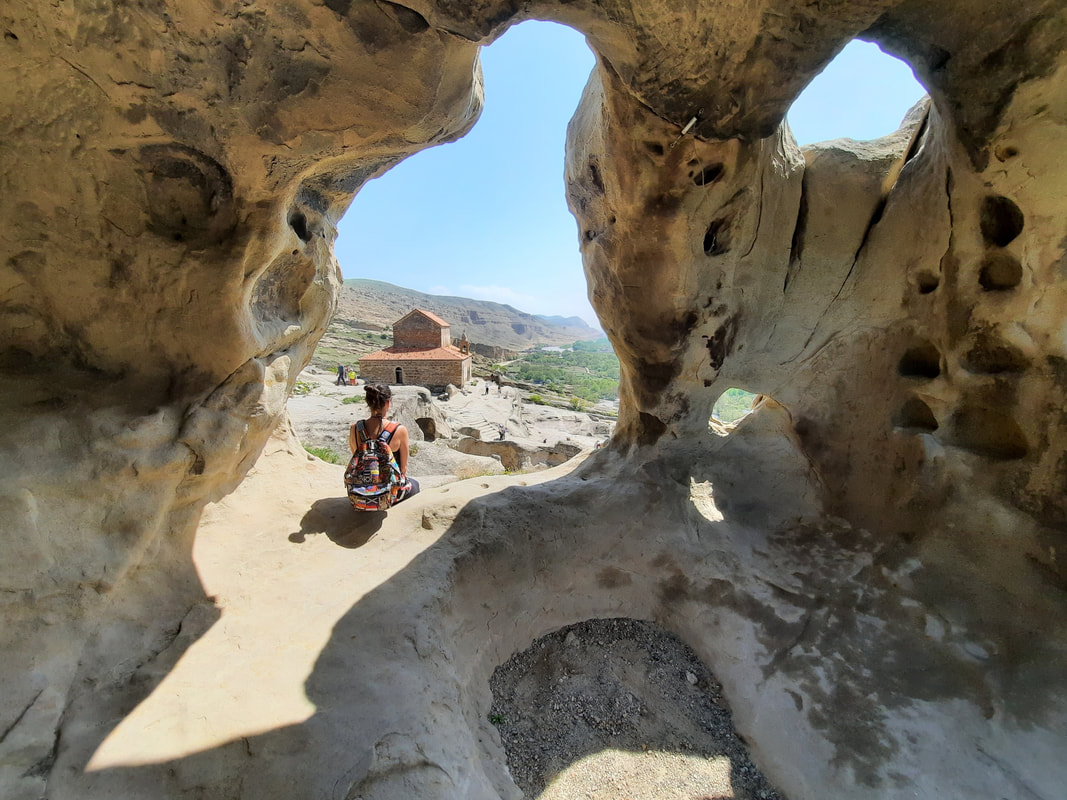
Photo by Miles Watson Photography.
Transport
Next?
Transport
- Walking: Borjomi is tiny, and all sights are within walking distance. Gori is bigger and more spread out, but walking is still a good option to get around and check off all the sights.
- Cycling: Cycling is only for the bravest among us. Calling local traffic “hectic” is an understatement. Georgian drivers are among the most reckless I have seen worldwide. Generally, people don’t even take other drivers into account, let alone cyclists who form a rare sight on the Georgian roads.
- City Buses / Tram / Metro: Borjomi and Gori are served by minibuses (called “mashrutkas”). Navigation apps such as Google Maps and Moovit don’t work here, so talking to locals is the only way to figure out which bus to take.
- Taxi / Uber: The main taxi apps are Yandex Go and Bolt. I recommend using these over hailing down a taxi on the street, so you can avoid being overcharged. Keep in mind: It’s quite common for taxi drivers around the bus stations to tell you a certain bus has been cancelled and your only option is taking a taxi… This is in 99% of the cases a lie.
- "Intercity Buses: The main way of city-to-city transport in Georgia is by minibus / “mashrutka.”" Most destinations are labelled on the front window, but generally only in the Georgian alphabet. You can ask around and people will helpfully point you in the right direction. A downside of the mashrutkas is that traveling with a big backpack / suitcase can be rather complicated (sometimes an extra fee is charged), as there’s hardly any storage space. Especially considering the sheer amount of people that are crammed in during the ride, eventually standing crouched over in the pathway and sitting on each other’s laps. Another nuisance is that mashrutkas get cancelled if not enough people get in, which can considerably prolong your anticipated travel time. Borjomi’s central bus station is right on the main street, next to the central market. Gori’s main bus station, serving destinations outside of Gori, is located quite far away out of town at the Tskhinvali Highway (unlike what Google Maps suggests).
- Train: Trains in Georgia are served by Georgian Railway (purchasing a ticket online doesn’t work quite well – it’s much easier to just buy it at the station). "Taking a train here is something you’d do for the experience only, as not only are the trains leaving less frequent than the mashrutkas, they’re also slower, serve less destinations and cost more. Kutaisi I is the main train station. Kutaisi II serves Tskaltubo.
- Car Rental: Car rental is rather pricy in Georgia and only suitable for very confident drivers. The local traffic situation is a complete mayhem and might not resemble what you’re used to at home. I recommend taking the most extensive insurance package, as damage is easily made when looking at the road behaviour of most drivers.
- Airport: Tbilisi International Airport (TBS); David the Builder Kutaisi International Airport (KUT).
- Hitchhiking: is rather common in Georgia. Yet, my experience is that not everyone is keen to stop and at times you might have to wait a bit (although for a woman / couple it will always be much faster than for a man, as a rule of thumb anywhere in the world). You don’t have to trace down a convenient pull-over strip, as drivers will stop anywhere, even if it blocks all other traffic. Take into account that English (or any other language but Georgian and Russian) is not widely spoken, so chit-chat might be complicated. More info at Hitchwiki.
Next?
- National Destinations Close By: Kutaisi; Chiatura; Tbilisi.
- International Destinations: Armenia; Azerbaijan; Turkey; Russia.
|
|
|
In order to support the travelers’ community, I spend many hours per week to adequately document all information and advices for prospective visitors, accompanied by a (hopefully) entertaining insight into my personal observations and experiences. This service is and will remain free. However, if you voluntarily want to make a contribution and support my travels and thus the creation of new stories and information supply, here is the button you’re looking for:
Related:
- The best hiking destinations of Armenia: Mount Aragats, Dilijan and the southern Legend's (Transcaucasian) Trail
- Europe's best skiing & hiking: Get your ass over to jaw-dropping Switzerland!
- The 3 golden rules to travel Sofia on a budget! & Why you shouldn’t miss out on Plovdiv! [Bulgaria]
- Check out Budget Bucket List's FAVORITE HIKING DESTINATIONS worldwide!
- Visit Balkan's finest: Montenegro's National Parks Blog, Kotor Bay & Lovcen NP and Cetinje, Podgorica, Prokletije NP and Montenegro's Coastal Towns Blog
- 10 typical Dutch celebrations no traveller should miss out on
- History preserved: Time capsule of Romanian culture Maramures
- Get your Albania itinerary ready: Berat, Gjirokastër, Korcë / Ohrid Lake, Theth, Shkodër, Tirana, Mount Korab & the coast!
- The 3 golden rules to travel Sofia on a budget! & Why you shouldn’t miss out on Plovdiv! [Bulgaria]
- Where modern meets classic: Vilnius, Lithuania
- 8 ways to save money in Vienna, Austria
- German gems: Aachen & Frankfurt am Main
- Europe's best skiing & hiking: Get your ass over to jaw-dropping Switzerland!
- Budget Bucket List hitchhike trip to... Kosovo!
- Unravel the mysteries of Serbia
- Discover the splendours of Turkey: Istanbul on a Budget & Reasons to visit Edirne