Prokletije National Park & Surroundings
For budget tips & compact place-specific travel info... Download my FREE Budget Fact Sheets. You're welcome.
| Download Steph's PROKLETIJE Quick Budget Fact Sheet | |
| File Size: | 283 kb |
| File Type: | |
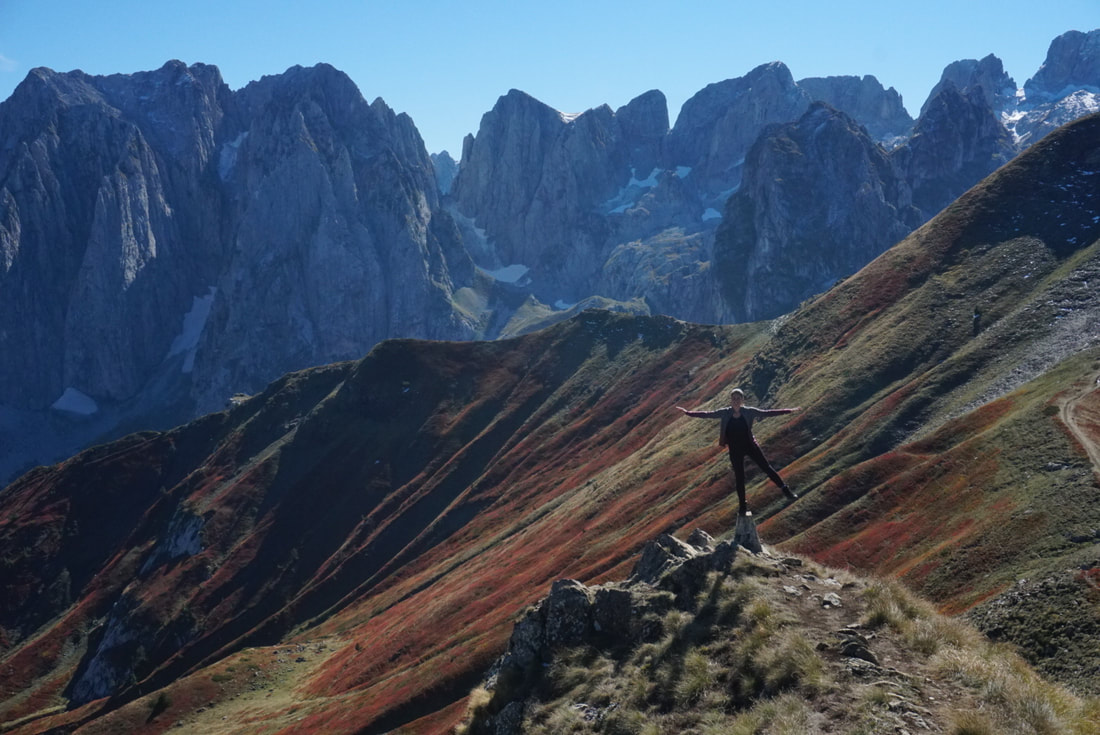
Prokletije National Park is my #1 destination in Montenegro. There, I said it. Yes, I travelled this tiny country for about a month and yes, I have visited Montenegro’s most beloved: Kotor and Durmitor… but Prokletije can top even their magnificence. What makes it even better is that it’s completely off the grid and rather complicated to reach by public transport, which keeps the crowds at bay. Many tourists haven’t even heard about it… but you did just now, so I took away that excuse. I go as far as to state that if there’s only one destination you have time to visit in this country, make sure it’s this one.
Prokletije, translated as the “Accursed Mountains”, got its name from its insurmountable and wild character. It’s the youngest national park of Montenegro (2009), although the Prokletije-area on the Albanian side compromises two other, earlier established national parks: Theth and Valbonë.* Prokletije National Park forms a part of the southernmost subrange of the Dinaric Alps and its appearance is characterized by rough karst peaks, steep slopes, dramatic gorges, active glaciers and glacial lakes. The mountain range includes various rivers and provides a home to a wide variety of tribes roaming the hills as sheep herders (among others: the Hoti, Kastrati, Gashi, Kelmendi and Shrekli), as well as a rich presence of local flora and fauna. Up until date, over 1700 plant species have been discovered, of which 50 endemic, representing 50% of Montenegro’s total plant life. Beech, spruce and fir forests cover the lower mountain areas. Due to its pure, uncontaminated nature, the area attracts a rich collection of animal species, such as brown bears, lynxes, chamois, deer, grey wolves, wildcats, fire salamanders, Greek tortoises, golden eagles, horned vipers (so be careful!), otters, red foxes and over 140 types of butterflies… many species extinct elsewhere in Europe!
* Read more about Theth and Valbonë soon!
Photo & Banner Photos by Miles Watson Photography
The Hikes of Prokletije
Base
First of all, it’s worth making a decision about your hiking base. Personally, I chose Plav, because it’s well-serviced with many supermarkets, restaurants and shops, plus it’s located rather scenically along the stunning Plav Lake and not too far from the starting points of the hikes (mind you: by car). I stand behind the choice of exploring Plav and its surroundings, as it truly is outstanding… However, I do think it’s better as a daytrip-destination. In retrospect I would have chosen the more conveniently located Gusinje as a base to hike Prokletije. Gusinje is smaller and has a less pleasant feel to it, but has all facilities you might need, and from there you can either drive or hitchhike towards Vusanje or Škala where the hikes start. The villages of Vusanje and Škala have accommodation options too, with the option to dine in (no shops nor ATMs there!), and the surroundings of these tiny villages are downright breath-taking. However, if you want to do more than just one hike you will have to loop around the mountains passing Gusinje again (in order to get from Vusanje to Škala, or from Škala to Vusanje).
* If you happen to stay in Plav: this short 16.5km hike provides great look-outs over the lake.
|
|
|
|
* From left to right (or in mobile version from the top-down): Plav - Vusanje - Škala
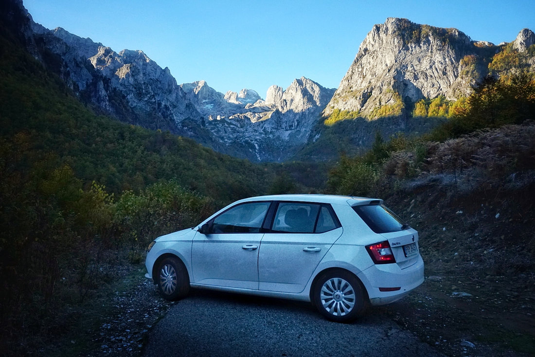
Keep in mind: Public transport reaches only as far as Plav and Gusinje, but this is not where the hikes start! There are no public transport options to the beginnings of the trails, so you need to either be comfortable with hitchhiking (you’ll have most luck in the weekends), or rent a car. I personally have a very good experience with renting a car in Montenegro and truly recommend it to allow yourself to uncover the more remote and unspoiled destinations of the country. On top of that, the relatively short distances and reasonable gas prices make it a budget travel option. Drive Montenegro, located in Podgorica, provided me with a quality vehicle and friendly customer service.
Keep in mind: Public transport reaches only as far as Plav and Gusinje, but this is not where the hikes start! There are no public transport options to the beginnings of the trails, so you need to either be comfortable with hitchhiking (you’ll have most luck in the weekends), or rent a car. I personally have a very good experience with renting a car in Montenegro and truly recommend it to allow yourself to uncover the more remote and unspoiled destinations of the country. On top of that, the relatively short distances and reasonable gas prices make it a budget travel option. Drive Montenegro, located in Podgorica, provided me with a quality vehicle and friendly customer service.
Photo by Miles Watson Photography
Zla Kolata Hike – Montenegro’s Highest!
Starting point: Vusanje. Parking at the Moonlight Guesthouse.
Distance: 17.2km (steep!)
Elevation gain: 1649m (highest point 2534m)
Level of difficulty: Moderate without snow, difficult with snow.
Notes: There is one water stream along the way to refill. Trail signs sometimes lack, and sometimes they overdo it by marking different routes with the exact same colors, which is very confusing. It’s best to download the route on GPS and use that as a reference. Specifically pay attention at the border area before the last and steepest ascend. You’ll hike on the border of Albania, so officially you should carry your passport… but it’s not like someone sits there on the mountain all day checking people’s ID’s, so no stress. This trail is a stretch of the famous Peaks of the Balkans Trail.
There’s this one tradition my travel partner and I recently started: Hike the highest peak of every country we visit (within reason). It was long believed that in Montenegro this point is the Bototov Kuk (2523m) in the Durmitor National Park… But no, it is not: New facts show that the highest peak is in fact the Zla Kolata, which is with 2534m exactly 11 meters higher. And you guessed it, this one is located in the Prokletije National Park, so you’re gonna climb it!
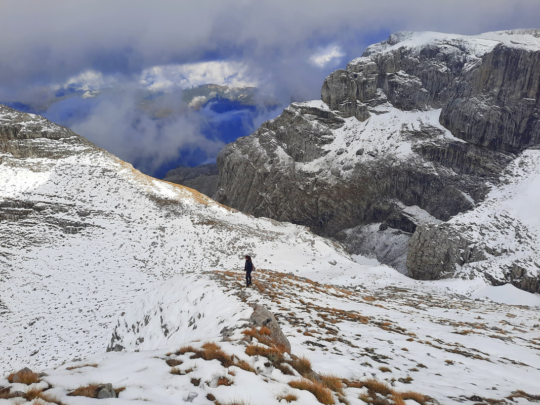
I wasn’t too worried about this one, as with a full day on our hands and just 17km of distance this didn’t seem like too much of a challenge. Turns out, in winter when it gets dark at around 4PM you do not have sufficient daylight to start halfway the morning, plus 17km definitely is a considerable distance if you take into account that many of those kilometres are walked straight up… and the hardest, steepest part of the trail has disappeared entirely under a thick layer of snow. Yup, I definitely underestimated that one! But it was by all means worth it. The valley of Vusanje alone will swipe you right off your feet… it’s hard to fathom that this is a real place on earth with people calling it their home. When beauty like this exists, why do people even consider living in a city? Well, try to think about that when you’re walking, as you got quite the trail ahead of you!
Photos by Miles Watson Photography
It starts rather laid-back with the first 2km on a boring dirt road, which is nevertheless continuously inclining. Pay attention to where to take the trail to the left, as it’s not too obvious (and the dirt road continues with a mild bend to the right). GPS comes in handy here! The trail is a rather pleasant one, leading you through forests and fields, every now and then granting you pleasing panoramas. The level of difficulty is turned up a notch when you enter the rocky part, the eroded rock formations being quite complicated to hike on. Once you reached an opening with a direction-indicator informing you that the Zla Kolata is 3,5 hours ahead of you, please don’t panic… it is not. Even in the snow it took us about half of that time. Yet, it’s not going to be easy from here on, and you’ll soon see why. I can still feel the moment the Zla Kolata rose up in front of me. That is one BEAST of a mountain. Whereas the Midžor in Serbia or the Korab in Albania lead you up gently, without making you feel how much elevation you’re gaining (Albania’s Korab is in fact much higher), this one just intimidates every last inch of courage right out of you. But you’re here now, with Montenegro’s highest peak within eye-sight, so you’re continuing of course. Even if it’s already getting dark, the trail has disappeared under that snow, and you’ll have to return with snow-soaked shoes and freshly blistered feet in the pitch-dark over uneven terrain. The stuff I put us through. But we did it, we bloody did it! And so will you.
It starts rather laid-back with the first 2km on a boring dirt road, which is nevertheless continuously inclining. Pay attention to where to take the trail to the left, as it’s not too obvious (and the dirt road continues with a mild bend to the right). GPS comes in handy here! The trail is a rather pleasant one, leading you through forests and fields, every now and then granting you pleasing panoramas. The level of difficulty is turned up a notch when you enter the rocky part, the eroded rock formations being quite complicated to hike on. Once you reached an opening with a direction-indicator informing you that the Zla Kolata is 3,5 hours ahead of you, please don’t panic… it is not. Even in the snow it took us about half of that time. Yet, it’s not going to be easy from here on, and you’ll soon see why. I can still feel the moment the Zla Kolata rose up in front of me. That is one BEAST of a mountain. Whereas the Midžor in Serbia or the Korab in Albania lead you up gently, without making you feel how much elevation you’re gaining (Albania’s Korab is in fact much higher), this one just intimidates every last inch of courage right out of you. But you’re here now, with Montenegro’s highest peak within eye-sight, so you’re continuing of course. Even if it’s already getting dark, the trail has disappeared under that snow, and you’ll have to return with snow-soaked shoes and freshly blistered feet in the pitch-dark over uneven terrain. The stuff I put us through. But we did it, we bloody did it! And so will you.
When in Vusanje, there’s another sight you cannot skip, especially in colorful autumn: The Eye of a Grasshopper… or: Oko Skakavice. If you wonder where that name comes from, I invite you to take a peak at the photos below. This sight doesn’t enquire a challenging hike nor a lot of time. It can be reached by a 4x4, or alternatively it’s at a 15min. flat walk from the village.
Three Peaks Hike (Valušnica, Talijanka, Popadija)
Starting point: Škala / Grebaje Valley. Public parking close to the start of the trail.
Distance: 10.1km (walking time 3 hours, but incl. lunch and photo stops allow 5 hours)
Elevation gain: 1126m (highest point 2014m)
Level of difficulty: Moderate.
Notes: There is a water stream in the meadow where you can refill (at the beginning/end of the mountain loop - just after/before the forest stretch where you have to backtrack a bit). The trail is rather straight-forward and clearly marked. However, there are several routes that can make the trail longer or shorter, so GPS-navigation and an offline map is convenient to have downloaded. There is no phone signal here, so do this in advance. I recommend walking the trail counter-clockwise for the best views. This trail also dips into Albania and forms part of the Peaks of the Balkans Trail. Find GPS here.
Unlike the Zla Kolata hike, the Three Peaks Trail is very well-traversed and popular. Don’t expect the crowds you’ll see in Durmitor or Lovcen National Park, as Prokletije is simply too remote and hard to reach for that kind of tourism… but expect some people, opposed to no people at all on the other trails, this hike being the main “attraction” of this otherwise rather undiscovered area. It must be said: with a very clear reason. This hike truly is a winner. The drive towards Škala will already take your breath away. A massive wall of mountains, magically lit up by the early orange sunrise, simultaneously frightens and strongly lures you in… drawn by this force of nature.
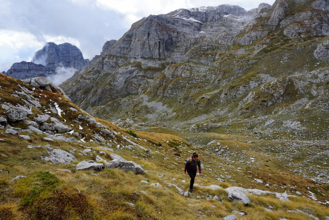
The trek kicks off with an ascending forest walk, the trees protecting you from the heat of summer and enticing you with its wild pallet in autumn. Suddenly the woods dramatically open, allowing you to peak through the leaves to see an almost unreal tableau: A stretched out meadow, entirely dotted in intense blue shades like a pointillist artwork assembled by endless blueberry bushes. A blue dreamscape spread out like a carpet towards the dramatic ridges of the Dinaric Alps. And you’re going to traverse through all of this splendour, what a time to be alive! Stretch up for some serious steepness, straight up the side of the ridge.* That said: The good news is that once you’re up, you stay up for a while. Most of the hike leads you straight over these thin ridges, treating you on 360-degrees views all the way through. Looking around me I realized that I had reached the pure essence of Montenegro. What I was seeing at that very moment is the one photo you’d put on the cover of a Montenegro-guide… this is what a country with a name like that should look like. Yet, most visitors don’t even get to see it. Well, aren’t we the lucky few?
* Bring your hiking poles. The descend at the end of the loop is muddy and slippery.
Notes:
- Officially there’s an entry fee for Prokletije National Park (anno 2022 only €1). However, during my visit in off-season, there was no control nor ticket booth, so paying wasn’t required.
- Spring, summer and early autumn are the prime hiking seasons. Be prepared for rough weather conditions and ice/snow during the rest of the year.
- Always bring wind- and waterproof clothing, extra layers, a hat and more food and water you think you need (in case you get stranded). Proper hiking boots and hiking poles are recommended. I personally always carry a small hiking kit which includes an emergency blanket, talc powder, a headlamp with extra batteries, a compass, first-aid-kit with tape and blister bandaids, a tick-remover, rope, sunscreen, duct tape and reflecting bands.
- Contrary to many other travel blogs, I most definitely do not recommend Maps.me. Not in Durmitor, not in Montenegro, and not in the entire Balkan. I very often got in trouble doing so. Maps.me depicts trails that don’t exist anymore, and could be entirely overgrown, demolished by construction work, or privatized and shielded off. If this is the only trail option you have it can cause enormous backtracking, which can waste the precious available daylight hours (especially in autumn and winter). I recommend downloading the offline trails from the Wikiloc app (or other GPS hiking apps), which allows you to precisely navigate.
- You’re reading a blog to prepare for your hikes: Good on you! You will not find any useful trail information on-site. My experience in Montenegro with park offices and tourist information points is that they are A) Closed altogether, B) Don’t have employees who speak any other foreign language, or C) Have employees that never did a single hike in the area and have absolutely no clue what they’re talking about, and as such recommend things that are either ridiculous or that can put your life at risk. I visited both the tourist office in Plav and the Prokletije National Park Office in Gusinje, and both were disappointing experiences fitting in the above categories.
Photos by Miles Watson Photography
In the Area
Biogradska Gora National Park
Are your legs begging for some more Montenegrin hiking? Great, you’re only a 2-hour drive away from yet another national park: Biogradska Gora. Its main draw is the 16 square km of virgin woodland, constituting one of the only three remaining primeval forests in Europe with trees of over half a millennium old! With that, it provides a completely different experience from Prokletije (less impressive, so to say). Expect rainforests, glacial lakes and some cheeky mountain ridges peaking out of the woods. Even though this smallest national park of Montenegro is laurelled a UNESCO Biosphere Reserve, it couldn’t really grab my attention after all the grandeur I had submerged in beforehand during my Prokletije adventure. I truly tried: I stayed a total of three days in a cosy wooden hut on a field somewhere in Mojkovac… but the weather wasn’t on my side, only allowing a short rainy lake-loop. Had I had the chance to knock out the 12km-loop leading to lookout-points such as the Crna Glava, Zekova Glava and Bendovac in bright weather, I perhaps would have written down an entirely different review.
But I didn’t, so it’s your turn now to make a different memory. This park is easy to reach (once again: by car!), and has a developed tourist infrastructure including a visitor centre, marked trails, paid campsites, and a big restaurant. The entry price is €3 (anno 2021). Kolašin is considered the base for this national park, but frankly, Mojkovac is closer and served by both a bus- and train station. I stayed at Eco Village Coric, which was affordable and quite scenically situated.
Southern Towns of Montenegro
Explore more: Alternate those overwhelming encounters with nature with civilization. Below I shortly describe some towns I visited around Prokletije and Biogradska Gora National Parks, forming potential stops on your Montenegrin road trip:
Explore more: Alternate those overwhelming encounters with nature with civilization. Below I shortly describe some towns I visited around Prokletije and Biogradska Gora National Parks, forming potential stops on your Montenegrin road trip:
- Kolašin came into existence in the 17th century as a fortress-settlement established by the Turks as a part of their expanded Ottoman Empire. However, most visible elements of this period have been destroyed in the numerous battles for liberation, as well as by heavy bombing during WWII. What’s left is… some weird collection of oddly shaped modernist buildings, composing a grey unearthly landscape looking lake some macabre version of Teletubby-land. Needless to say, that speaks in its favour: Weird is good. Therefore, I visited twice.
- Grey, depressing and remarkably uninviting… there’s very little appeal to Mojkovac. Yes, it is the best base to the Biogradska Gora National Park, easily reached by car, bus and train and well-serviced in terms of shops and supermarkets… But besides the Zabojsko Lake and the Old Bridge there’s very little selling points to this location.
- Berane also couldn’t entirely shake off this gloomy, communist flair heavily laying over some bigger Balkan cities. However, its charming location surrounded by lavish slopes and its lively city center is an easy distraction. It’s an interesting stop on a local roadtrip, not so much for its long list of tourist attractions, but to slowly submerge in the daily life of the Montenegrins without the tourist madness of destinations such as Kotor and Budva far-far-away.
- Similar arguments can be made in favour of Bijelo Polje. Besides a simple Heritage Museum and the conspicuous Gradska Džamija mosque, there are very few checkpoints drawing in the tourist crowds. And that is exactly its main attraction. Strolling lazily over the lively shopping streets and leaning back in a chair sipping on a Turkish Coffee and nibbling on a Burek watching daily Montenegrin life pass by… more real experiences coloring in the journey.
In order to support the travelers’ community, I spend many hours per week to adequately document all information and advices for prospective visitors, accompanied by a (hopefully) entertaining insight into my personal observations and experiences. This service is and will remain free. However, if you voluntarily want to make a contribution and support my travels and thus the creation of new stories and information supply, here is the button you’re looking for:
Related:
- Check out Budget Bucket List's FAVORITE HIKING DESTINATIONS worldwide!
- Visit Balkan's finest: Montenegro's National Parks Blog, Kotor Bay & Lovcen NP and Cetinje, Durmitor NP, Podgorica and Montenegro's Coastal Towns Blog
- Get your Albania itinerary ready: Berat, Gjirokastër, Korcë / Ohrid Lake, Theth, Shkodër, Tirana, Mount Korab & the coast!
- The best hiking destinations of Armenia: Mount Aragats, Dilijan and the southern Legend's (Transcaucasian) Trail
- Be about Bulgaria: Check off Bansko, Belogradchik, Plovdiv, Sofia and of course Veliko Tarnovo!
- Europe's best skiing & hiking: Get your ass over to jaw-dropping Switzerland!
- Budget Bucket List hitchhike trip to... Kosovo!
- Where city and nature meet: Edinburgh, Scotland
- Read about Bosnia & Herzegovina: Mostar, Blagaj, Trebinje, Sarajevo, Jajce, Banja Luka and Sutjeska National Park (incl. Maglic Peak - the country's highest!)
- Unravel the mysteries of Serbia
- Discover the splendours of Turkey: Istanbul on a Budget & Reasons to visit Edirne
- Get deep into Greece: Athens, Delphi, Arachova, Mount Parnassos NP, Epirus, Meteora, Thessaloniki & Volos
- Archeological treasures, UNESCO sights and Greece's roughest nature: Explore the Peloponnese!
