Kazbegi (Stepantsminda)
Not in the story-mood? Scroll down for the Quick Budget Fact Overview: an itemized information summary of Kazbegi↓
What comes to mind when someone drops the word “Georgia”? Not much, in my case. I knew it wasn’t just one of the United Sates, but also an actual country on the border of Asia, Europe and ancient Persia… and I knew it had some mountains. In short: It was about time to expand that knowledge! So I created the splendid opportunity to get myself over there to take a more thorough look.
I stayed a month. Then I came back for yet another month to hike the (finally snow-free) mountains of the illustrious Caucasus. To state that I came under Georgia’s spell is a gentle understatement. Can you blame me? As an outdoor enthusiast it’s close to impossible to stay calm when presented with an almost hysterical natural variety of subtropical coastlines, alpine meadows, semi-deserts, fertile valleys, swampy wetlands and a seemingly endless choice of 5000+ meter peaks (to put it into perspective: 12 Georgian mountains trump the Mont Blanc – say what?!). How was this country out there all this time, without me even being informed enough to merely daydream about it?!
I stayed a month. Then I came back for yet another month to hike the (finally snow-free) mountains of the illustrious Caucasus. To state that I came under Georgia’s spell is a gentle understatement. Can you blame me? As an outdoor enthusiast it’s close to impossible to stay calm when presented with an almost hysterical natural variety of subtropical coastlines, alpine meadows, semi-deserts, fertile valleys, swampy wetlands and a seemingly endless choice of 5000+ meter peaks (to put it into perspective: 12 Georgian mountains trump the Mont Blanc – say what?!). How was this country out there all this time, without me even being informed enough to merely daydream about it?!
Photo by Miles Watson Photography.
Hikes of Kazbegi National Park
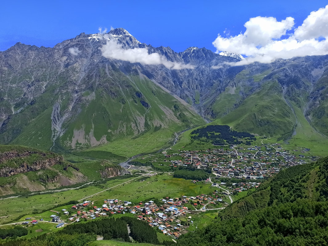
7% of entire Georgia is covered by national parks and protected reserves, and arguably the most renowned one of ‘em all is Kazbegi National Park. Its thriving popularity can be partly ascribed to the easy accessibility. Whereas it takes 4-5 long hours (1-way!) to traverse Georgia’s most dangerous road cutting right through the Abano Pass to reach Tusheti National Park, the journey to Kazbegi couldn’t be more straightforward by simply taking a cheap and direct “mashrutka” (minibus) from the capital Tbilisi. Another obvious reason is its undeniable magnificence. It doesn’t matter if you are a seasoned mountaineer or just a no-frills-daytripper, I have yet to meet the person who is unable to appreciate this dramatic spectacle of rugged, snow-sprinkled peaks surrounding Kazbegi’s thriving heart: the decent-sized town of Stepantsminda.
While we’re comparing Kazbegi with Tusheti now anyway: Even though Tusheti is far more remote and therefore unspoilt, Kazbegi is more practical. Here you don’t have to transport all your food and supplies for the expected time frame you’ll spend here (which will undoubtedly be longer than initially planned), as Stepantsminda offers a wide variety of shops and supermarkets to cater to your everyday needs. Also: Here you don’t have to rent a driver or wait hours alongside the deserted roads to please-pretty-please get a hitchhike to reach the barely existent daytrip-trails… Kazbegi has an extensive and easy-to-reach trail-infrastructure, offering a varied network of easy-to-follow hiking paths catering to all levels of fitness. A hiking paradise for the masses… but quite gratefully so, as no one should be allowed to miss out on this.
Let’s have a look at the available hikes of Kazbegi, shall we?
Photo by Miles Watson Photography.
Day Hikes
[Keep in mind that levels of difficulty are very personal. What is difficult for the standard tourist who hardly ever hikes, is a “walk in the park” for a seasoned trekker. I’m a trained and regular hiker, acquainted with mountainous conditions, and as such I qualify relatively flat hikes with pleasant, even trails as “easy”. Every person in decent health should be able to do these, and to fervent hikers they don’t represent a challenge. “Intermediate” hikes include some more demanding and steep stretches and are generally of a decent distance, making it suitable for relatively fit people who hike regularly, with a pleasant challenge here and there. Untrained hikers might regard these intermediate hikes as demanding. “Difficult” hikes involve technical ascends and descends, potential uneven and challenging trail surfaces requiring upper concentration (incl. potential off-trail sections), as well as considerable distances (25-40km for a day trip). “Advanced” hikes require excellent mountaineering and navigation skills, special equipment and potentially a mountain guide.]
Juta to Roshka - via the Chaukhi Pass & Abudelauri Lakes
Distance: ± 12 km roundtrip until the Chaukhi Massif and back, 15km roundtrip if you also ascend to the top. 20.5km 1-way from Juta until Roshka.
Elevation Gain: 378m (unless you decide to go up the Chaukhi Massif).
Level of Difficulty: Juta and Chaukhi Valley: Easy. Juta to Roshka via the Chaukhi Pass & Abudelauri Lakes: Intermediate. In order to cross the Chaukhi Pass, you must double-check the conditions in advance, as it can stay snowy until well into June. In snowy conditions special equipment and mountain guidance is needed, and it will be categorized as “advanced.”
Starting Point: Juta. During my time of visiting the road had been damaged due to heavy rainfall and cars were only allowed to drive up until 2.8km before the village of Juta. This added another 5.6km to the total hiking distance. There is no public transportation to Juta. Your options are: Getting a taxi, which is by all means overpriced (they know how to milk the many tourists in Kazbegi); Reserving a transfer at the Mountain Freaks Travel Agency, taking note of the fact that the price of a 1-way or return-trip are the same, which makes it unsuitable for people preferring an overnight; or hitchhiking, which is manageable (I did it both ways), but you must take potential long waiting times into account due to a limited traffic flow. There’s also no public transport serving Roshka, so you must arrange a taxi or transfer in advance. It’s possible to get a taxi from Roshka to Barishako, which has 3 weekly departures to Tbilisi.
GPS: Juta and Chaukhi Valley here (recorded until the Chaukhi Pass summit, so slightly longer). Juta to Roshka via the Chaukhi Pass & Abudelauri Lakes here.
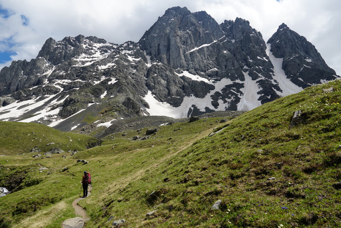
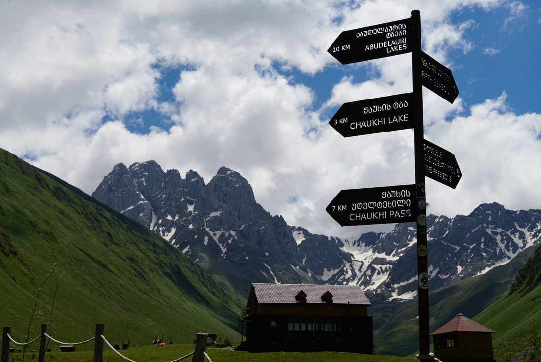
This hike is a winner from the beginning until the end. It starts with the scenic arrival to Juta village, which quite frankly is an attraction on its own, but it just keeps getting better every step you get closer to the Chaukhi Massif. Add to that the low level of difficulty and as such the easy attainability of these fantastic views, and you understand why this is one of the most popular day hikes in the entire Kazbegi region.
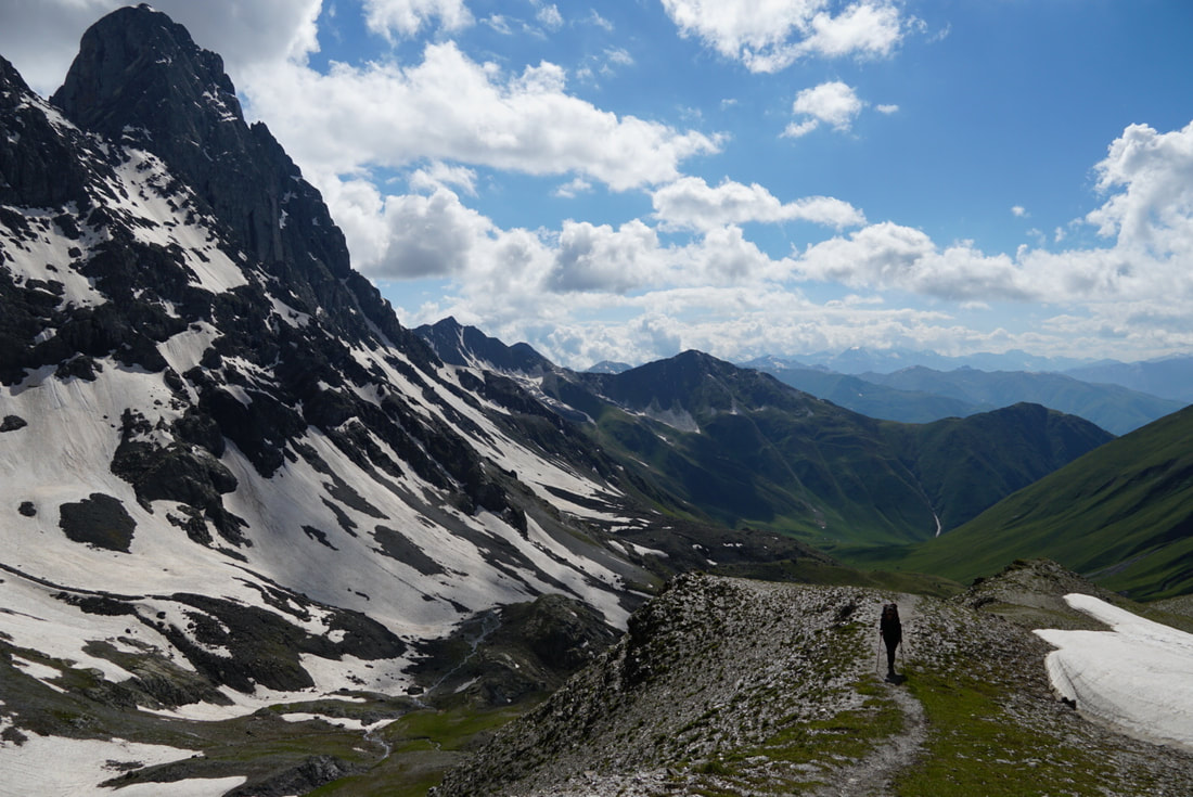
However, only a small percentage of the Juta-crowds know this… but it gets even better if you take the physical effort to mount the Chaukhi Massif and continue down to the Abudelauri Lakes. Personally, I turned it into a 2.5-day-endeavour, making a full-on loop including Roshka and returning via the Sadzele Pass (for more information: scroll down to the multi-day section)… but with a decent level of fitness you can do the 1-way Juta-Roshka stretch in just one day*, given you have arranged private transport back to Juta. It might seem like a lot, but it’s good to know that the Juta-Chaukhi-Massif-section and the trail from the Abudelauri Lakes to Roshka are downright easy. The demanding parts include the ascend onto the Chaukhi Pass, which however won’t take more than 30-45 sweaty minutes (it’s much harder and longer from the other side), as well as the steep way down towards the Abudelauri Lakes over loose and slippery gravel.
* Especially because in case of a daytrip you won’t be carrying heavy camping equipment and food. I don’t recommend hiking from Juta to the Abudelauri Lakes and back to Juta in 1 day. This is too much. Not so much in distance, but you must also take into account that the hike back up from the Lakes to the Chaukhi Pass is downright brutal. You can go up to the Chaukhi Pass and turn around, not including the descend/ascend to and from the lakes.
Variation: If you don’t want to deal with the hassle of getting yourself out of Roshka somehow, but the simple Chaukhi Valley stretch doesn’t offer the challenge you seek, you might want to consider summiting Mount Mukhadze, west of the Chaukhi Massif. It follows the classical valley trail, but makes a detour to include this 1187m ascend. (Intermediate)
Photo by Miles Watson Photography.
Gergeti Trinity Church & Glacier
Distance: ± 8.5 km roundtrip to Gergeti Church from Stepantsminda (there are several different routes). 23km roundtrip to the Gergeti Glacier and back. If you want to enjoy the great views a bit longer, it’s possible to spend the night in the Altihut or adjacent campsite, next to the glacier.
Elevation Gain: 580m to the Gergeti Church. 1724m to the Gergeti Glacier.
Level of Difficulty: Intermediate, both. The Gergeti Church Loop is quite short and therefore of course much easier than the glacier variation… but if I’d tell you it’s a laidback hike, I would be lying. It’s very steep and definitely not suitable for the unfit among us! That said, the Stepantsminda – Gergeti Church – Gergeti Glacier Loop is much longer and involves way more elevation gain, and as such caters to reasonably trained hikers. Yet, it never gets technical or extremely challenging.
Starting Point: Stepantsminda. Taxis towards the Gergeti Church are available, but at an unreasonably high price. During my visit, a collective of cab drivers was actively scamming tourists by stopping private vehicles and demanding a 70-lari-fee (!) to continue driving these mere 4km up. Downright ridiculous. I recommend accelerating and racing straight passed them, with the optional finger in the air.
GPS: Gergeti Church Loop here. The Stepantsminda – Gergeti Church – Gergeti Glacier loop here.
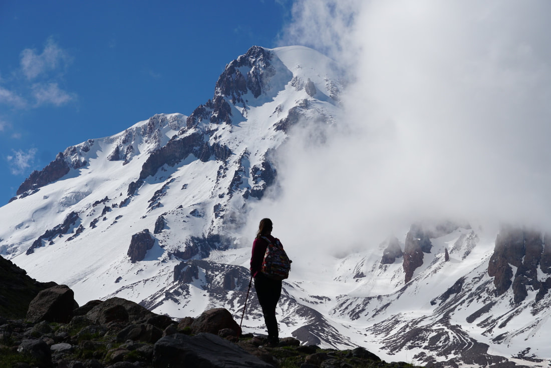
Many organized tourist groups travel all the way to Kazbegi in order to “check off” the Gergeti Monastery, and then go back. A crying shame, needless to say. I say this without downgrading the church itself, as even though the building isn’t utterly extraordinary in its own right, the situation of it in a downright mind-blowing evironment truly is. It’s a feature shared with almost all monastery complexes in both Georgia and Armenia… can’t blame those monks for lack of vision and sublime location-management. The “crying shame” represents itself in someone being in an outstanding place like Kazbegi, and having invested the time and money to get here, and then not even scratching the surface (more like stroking it, without major impact). Go higher, go further! Yes, the views onto the church, trembling into the majestic shadow of the robust peaks of the Caucasus, will sweep you right off your feet… so imagine adding a waterfall, a glacier and a first-row view of Mount Kazbeg into the mix! The holy trinity of Kazbegi! Even though the Glacier Loop is far from undiscovered and the lack of clear markings is compensated by a fully beaten path from start to finish… this is the case for obvious reasons. Opting for this route means shaping one of the core memories tied to your Georgia trip, balancing a continuous sequence of natural highlights with doable, moderate trails that are just challenging enough to feel rewarding (every steep ascend is followed up with a lil’ flat stretch to catch your breath).
Remark: I noticed that several Wikiloc trail recordings turn around at the first look-out point. Don’t do this, power through! Skipping the section passed the Altihut, granting first row views on the glacier and Mount Kazbegi (you’ll be standing right at its base), means skipping the best part of the entire hike.
Variation #1: If you started early and have energy left, as well as sufficient experience with glacier crossings, you can continue to the Bethlemi Hut (3653m). It is also possible to alternate the “traditional route” with the trail starting from / ending in Arsha village, passing the Arsha Falls*, climbing up to the Chkhati Valley and then connecting to the Altihut campsite. I haven’t done this variation myself, but I read it’s slightly longer and more challenging and as such requires an earlier start (I started the hike at noon – no time left!).
Variation #2: Feeling like a refreshing dip after sweating your tits off? Well, do I have news for you! If you make sure to return via the Gergeti village (an extension of Stepantsminda you’ll likely pass either up or down to the Gergeti Church anyway) you can follow a trail along the river towards Pansheti. Stop at the pool bordering the Vedza mineral water spring. Crystal clear water to drink and bathe in!
* The Arsha Falls can also be visited during a day-hike, starting off from Arsha Village (5km away from Stepantsminda). This can potentially be combined with a visit to the abandoned Toti Village. However, sheep flocks with shepherd dogs are a nuisance on this track. Find a trail recording here.
Photo by Miles Watson Photography.
Artkhmo Valley
Distance: ±12 km roundtrip.
Elevation Gain: 521m.
Level of Difficulty: Easy.
Starting Point: Akhaltsikhe bridge (on the way to Juta, about 4km passed the village of Sno). There is no public transport into this direction. If you don’t have your own vehicle, you can take an (overpriced) taxi or hitchhike, which is relatively easy as there’s a decent amount of traffic until Sno (from there you can either walk, or be patient for a lucky ride).
GPS: Here (a recording in more favorable conditions than my own).
I read good things about this small, desolate valley, stemming off the Snostskali Gorge and quietly leading to the abandoned Artkhmo Village. Even though it’s a 1-way trip, requiring a backtrack of the entire route, the relative easiness of this itinerary seemed like the perfect intermezzo between 2 relatively demanding days. If I only were that lucky… Even though allegedly May until November is the prime time for this track, I faced a flooded valley in early July after 2 weeks of steady rainfall. I took a deep breath and decided to just go for it, hopping from left to right through gushing streams and at times serious fast-flowing rivers. That grows old quite quickly though. An hour later I was only about 2km in, my socks were drenched, I had (un)tied my soppy shoes more often than I generally do on a daily basis and wood splinters stuck out of my bare feet. I was over it. I turned around: Mission aborted.
Alternative: Artkhmo Valley too easy (or too flooded) for you? Consider the Angel Mountain (3095m) trek departing from the nearby Sno village. It’s a time-consuming trek taking up to 8-9 hours (roundtrip – you backtrack on the same route you got up), but it’s not too demanding energy-wise and offers rewarding views over both Stepantsminda and Mount Kazbeg. On the peak you’ll find the ruins of a fortress and chapel, which functions as a place of an annual pilgrimage for locals. Still too light for your taste? Follow Angel Mountain’s ridge and continue onto the complicated and lengthy trail towards the Lerakt Pass. From here it’s possible to return via the Khvedisistskali River Valley.
Alternative: Artkhmo Valley too easy (or too flooded) for you? Consider the Angel Mountain (3095m) trek departing from the nearby Sno village. It’s a time-consuming trek taking up to 8-9 hours (roundtrip – you backtrack on the same route you got up), but it’s not too demanding energy-wise and offers rewarding views over both Stepantsminda and Mount Kazbeg. On the peak you’ll find the ruins of a fortress and chapel, which functions as a place of an annual pilgrimage for locals. Still too light for your taste? Follow Angel Mountain’s ridge and continue onto the complicated and lengthy trail towards the Lerakt Pass. From here it’s possible to return via the Khvedisistskali River Valley.
Truso Valley
Distance: ± 7-21 km roundtrip.
Elevation Gain: 282-489m.
Level of Difficulty: Easy.
Starting Point: Kvemo Okrokana. There’s no public transport to the trailhead. You can get an expensive taxi, book a return-trip at Mountain Freaks or hitchhike (get a ride to Almasiani on the main highway, and then turn right)
GPS: Here.
A valid alternative to the flooded Artkhmo Valley could have been the trail through Truso Valley. Yet, I was entirely unwilling. Why? Because I just spent a week in Tusheti and got severely traumatized by a terrifying shepherd dog attack… and I read that this is Kazbegi’s prime location to encounter them. Thanks, but no thanks! Seriously, they are no joke, I almost shat myself: They are the size of a small bear and trained to do some serious damage, encircling you to lock you in and only willing to back off if the shepherd tells them so (and for that, he has to be around!). It’s easy to say to “just stay out of their territory”, when these dogs often consider you being in “their territory” up to a mile away. How are you supposed to avoid them if you’re on a thin mountain ridge or in a narrow valley and they’re right on the middle of the trail without any options to go around them? I might sound paranoid, because I truly am… but I honestly prefer my unintended lunch right next to a coral snake (Florianopolis, Brazil) or my “fresh catch of the day” of a pufferfish (the venom of 1 fish can kill 30 humans – Nusa Lembongan, Indonesia) over the shepherd dog encounter I had in Georgia. [/ End of rant]. If you still want to go, have a go at the GPS recordings in the description.
Remark: As this hike goes into the direction of the Russian-occupied area of South Ossetia, it’s not possible to traverse the entire valley without a permit. The last freely accessible area is Khetrisi village.
Remark: As this hike goes into the direction of the Russian-occupied area of South Ossetia, it’s not possible to traverse the entire valley without a permit. The last freely accessible area is Khetrisi village.
Sioni, Mount Kabarjina & Sakhiznari Cliff Natural Monument
Distance: ± 8 km (trip with different beginning and end point).
Elevation Gain: 396m.
Level of Difficulty: Easy.
Starting Point: Sioni. You can start from the highway or from the church / defence tower. By all means, I recommend including the church in your trail to be able to enjoy the valley views.
GPS: Here. Be careful, you can encounter flocks of sheep in the valley, which are accompanied by aggressively protective dogs. It’s a wide valley, so use that to your advantage to keep a considerate distance.
I got acquainted with this option via the Mountain Freaks website. However, there was zero information to be found on the actual route… I couldn’t find a single GPS recording, nor any map of some sorts. Not even my fresh friendship with one of the Mountain Freaks employees (who I got to know via the Couchsurfing network) could be of any assistance, as she had also just started on the job and had never walked this trail before. Well, someone has to be the first one, right!? I present to you: The very first Wikiloc-recording from this laidback endeavour, initiated from the picturesque Sioni village, leading from the forest into the valley, along the Sakhiznari Cliff and onto the foot of Mount Kabarjina. It backtracks a tad, to return over a low mountain pass back to the main road, where you can easily grab a hitchhike or mashrutka back to Stepantsminda. There are many variations possible, but due to lack of consistent trail marks it’s hard to gauge the intended itinerary. The environment is truly worth exploring, offering relatively flat and easy (half-)day walks combining valley views, rolling hills, forests and landscape features that are quite different from what you have seen before in Kazbegi. Why? Because the sharply crowned Kabarjina is in fact a dormant volcano!
Gveleti Waterfalls
Distance: ± 3.5-4 km roundtrip.
Elevation Gain: 330m.
Level of Difficulty: Easy.
Starting Point: E117 Highway (point marked in GPS recording), 7km north of Stepantsminda. You either have to drive or hitchhike to this trail head (walking is a tad dangerous alongside the road). There’s some space for parking.
GPS: Here.
One of the easiest walks around is the little stroll to the Gveleti Falls, which is even shorter when starting exactly from the trailhead instead of from the highway (which is where most organized tourist-tours drop you off). There are technically 2 waterfalls, the small and the big one, but after reading numerous accounts of the junior one being sheite, I decided not to be the ∞’th person telling you this and skipped it entirely. Would I recommend the big one then? Probably neither, to be honest, unless you have time to kill. I mean, it’s not a horrible place to go to, but it’s just a waterfall. Water that falls… exactly like how it falls in thousands of places elsewhere in the world. Unless it’s the Iguazú or Victoria Falls or something, I don’t really understand what the fuzz is about. Especially in a place like Kazbegi, where sights such as alpine lakes, glorious peaks and thrilling glaciers are just around the corner.
Talking of which: If you want to extend this baby-walk into something more substantial, it’s possible to continue half-way to the Devdoraki Glacier by taking the miner’s road from Gveleti Village. Half-way, as since some deadly landslides took place in 2014, parts of the Kabakhi River Valley Trail have been closed off to the public for safety reasons. This bonus-track adds an extra hour to your trip (each way). As an extra side-trip, I can also recommend driving/hitchhiking towards the Russian border, where the castle-like Dariali Monastery Complex majestically welcomes anyone entering Georgia at this crossing.
Talking of which: If you want to extend this baby-walk into something more substantial, it’s possible to continue half-way to the Devdoraki Glacier by taking the miner’s road from Gveleti Village. Half-way, as since some deadly landslides took place in 2014, parts of the Kabakhi River Valley Trail have been closed off to the public for safety reasons. This bonus-track adds an extra hour to your trip (each way). As an extra side-trip, I can also recommend driving/hitchhiking towards the Russian border, where the castle-like Dariali Monastery Complex majestically welcomes anyone entering Georgia at this crossing.
St. Elias Church Loop
Distance: ± 5 km roundtrip.
Elevation Gain: 250m.
Level of Difficulty: Easy.
Starting Point: Downtown Stepantsminda.
Another one merely to kill some time. I haven’t done it myself, as in a place like Kazbegi National Park I’m always running out of time, but I’m aware of the satisfying views on Mount Kazbeg and the Gergeti Church from this standpoint. The church itself is recently constructed and rather tiny.
Photo by Miles Watson Photography.
Multi-Day Hikes
Juta to Roshka Loop (via the Chaukhi & Sadzele Passes)
Distance: ± 40-45 km (2 days – it can be shortened when not including Roshka, but instead taking a sharp left towards the Sadzele Pass after the lakes).
Elevation Gain: 2671m.
Level of Difficulty: The valley stretches: Easy / The Chaukhi & Sadzele Passes: Intermediate. In order to cross the passes, you must double-check the conditions in advance, as it can stay snowy until well into June. In snowy conditions special equipment and mountain guidance is needed, and it will be categorized as “advanced.”
Starting Point: Juta. During my time of visiting the road had been damaged due to heavy rainfall and cars were only allowed to drive up until 2.8km before the village of Juta. This added another 5.6km to the total hiking distance. There is no public transportation to Juta. Your options are: Getting a taxi, which is by all means overpriced (they know how to milk the many tourists in Kazbegi); Reserving a transfer at the Mountain Freaks Travel Agency, taking note of the fact that the price of a 1-way or return-trip are the same, which makes it unsuitable for people preferring an overnight; or hitchhiking, which is manageable (I did it both ways), but you must take potential long waiting times into account due to a limited traffic flow. There’s also no public transport serving Roshka, so you much arrange a taxi or transfer in advance. It’s possible to take get a taxi from Roshka to Barishako, which has 3 weekly departures to Tbilisi.
Huts / Campsites: None. It’s legal to wild camp anywhere. There’s accommodation available in Roshka, so it’s possible to travel light (but it doesn’t compare to waking up at the Abudelauri Lakes).
GPS: Here. Trail excluding Roshka here.
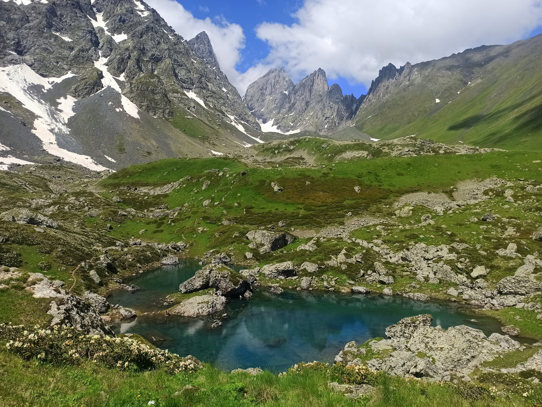
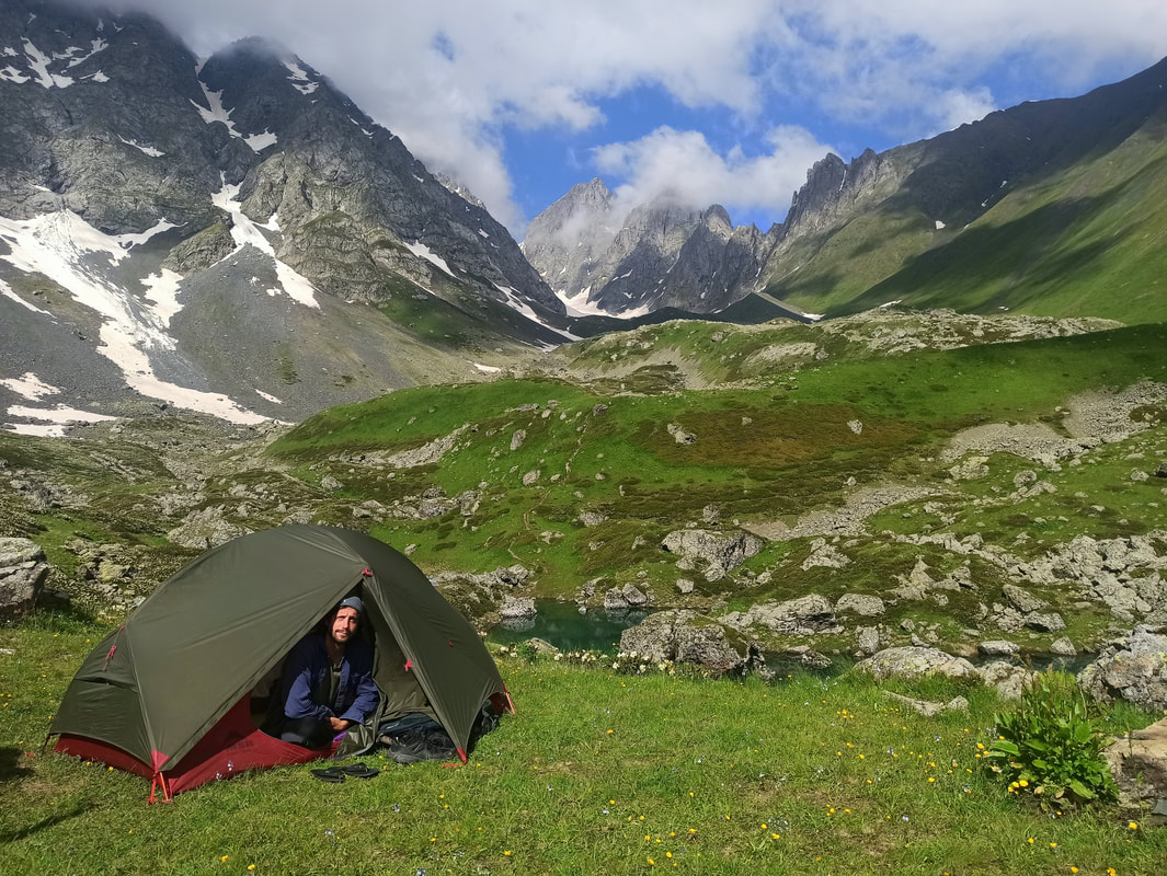
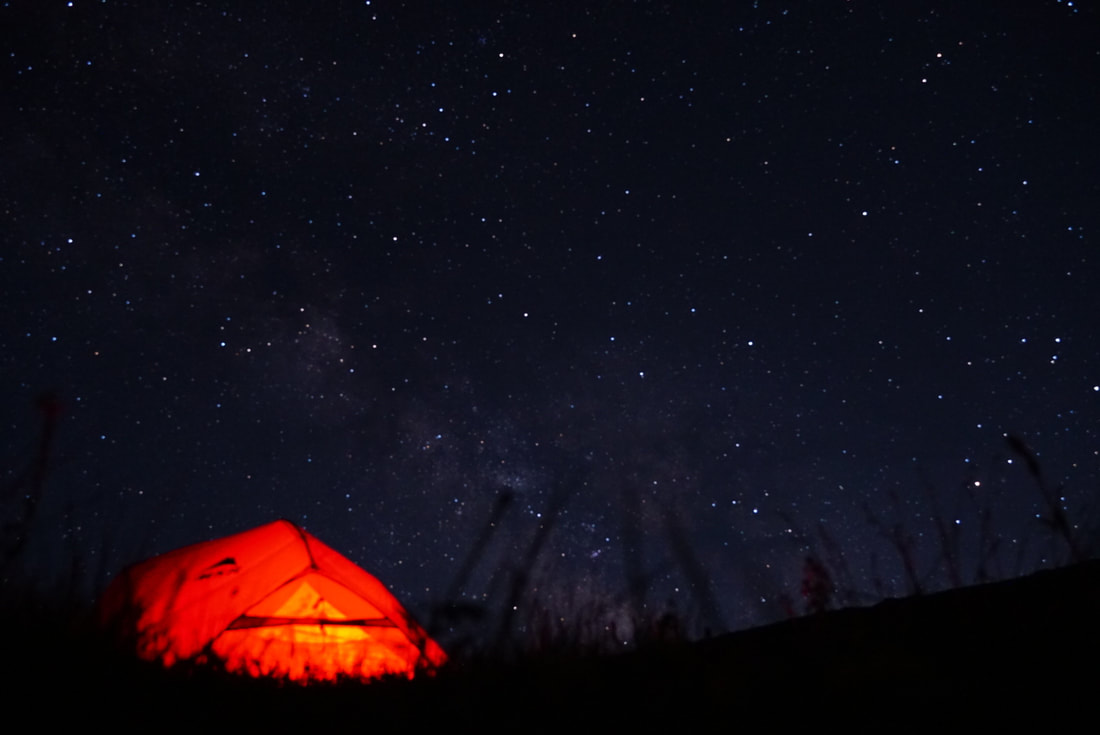
You just heard me raving about the sensational Juta – Chaukhi Pass / Roshka Day Hike. But why stop there? This easily represents the best trek I experienced in Kazbegi National Park… or potentially, during my 2 months in Georgia! All I wanted was spending as much time as possible in this downright heavenly environment… so I did. I packed up my tent and camping supplies, hitchhiked to Juta and simply started walking. I traversed the described Chaukhi Valley, mounted the Chaukhi Pass (3431 m), wrecked my knees descending towards the alpine Abudelauri Lakes and pitched my tent in the most scenic spot it had ever stood: right next to the Blue Lake, in the majestic shadow of the rugged Chaukhi Massif. Words are liable to be inadequate, so I just slap you in the face with the photos below:
That’s right. You want this.
I can’t believe this is a place that actually exists! After spending the night here it took me until well into midday to reluctantly peel myself away from this incredible sight, and even then I decided I didn’t want this hike to end. Good for me, as I had lost the turn-off to towards the Sadzele Pass and I was too stubborn to turn around and walk back those 10 lost minutes. Instead, I preferred to walk an extra 1-1.5 hour to reach the town of Roshka, where I decided I could buy the extra food supplies to spend yet another night en-route. So ehhh… yeah: There isn’t any food in Roshka. No shops, no restaurants, only very few guesthouses that prepare meals upon reservation… and when I desperately knocked on a guesthouse’s door, the lady of the house informed me that they had nothing left and waited on tonight’s delivery of groceries. Good I figured that out after I almost ran out of provisions. She must have seen the look of desperation in my eyes, and promptly decided to sell me yesterday’s bread and some cheese left-overs. It’s something! Thanks friendly lady!
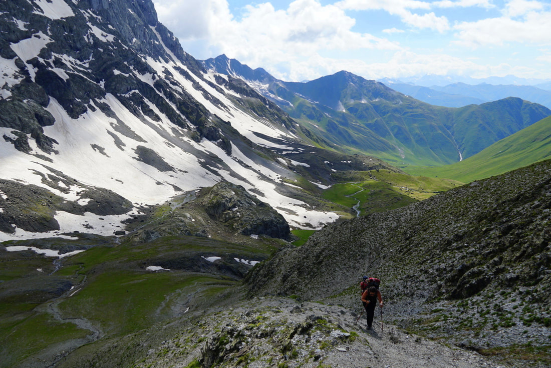
The stretch from Roshka towards the Sadzele Pass was pretty… horrifying. Where once lay a scenic trail, modern life bulldozered right over it. Be ready to walk a lame, monotonous 4km over a dusty dirt road (shared with vehicles)… or worse, through a steaming construction site, which was the case during my visit. When you finally connect back to the trail it might feel like a moment of bliss, but get mentally ready to put in some serious work. If you think the Sadzele Pass is easier than Chaukhi because it’s lower, you’re sorely mistaken: it’s the side you climb it on that determines the intensity. You see, from Juta the entire ascend is gradual, mildly kicking off from about halfway down the trail. On the Roshka-side, the valleys aren’t only deeper, the elevation also starts way more abruptly. Climbing up the Sadzele Pass from the Roshka-side is a serious and seemingly never-ending undertaking, much more difficult than getting up the Chaukhi Pass from the Juta-side! Like a little tortoise I slowly advanced up, step after calve-burning step, fighting my way through the hardest stretch of the trail. Surprisingly, even though the Chaukhi Pass was basically snow-free, here I had to slide over some slippery detours to surpass the icy snowpacks draped over the Sadzele Pass. Hard work that’ll soon be rewarded! The descend down into the Sadzele Valley is an easy-breezy stroll, keeping its cool all the way down to Juta (although it can get rather swampy due to the sheer amount of grazing cattle).
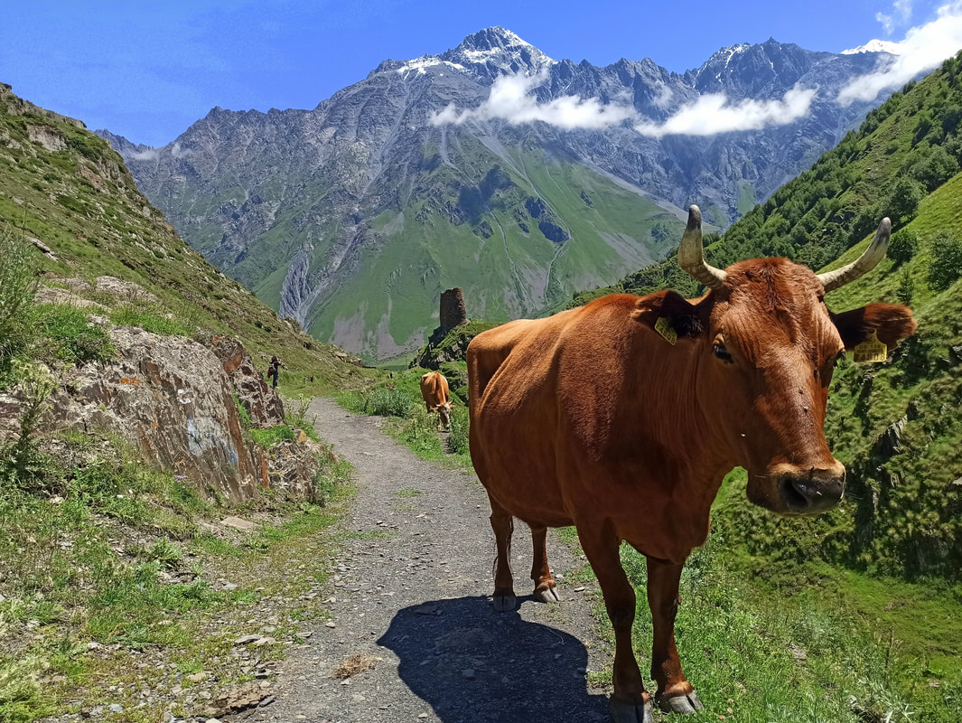
I could’ve walked back and completed the loop in 2 days, easily… but I plunged my tent down for 1 more night in the Sadzele Valley. Not as extraordinary as the Abudelauri Lakes (then again: very few places on Earth can compete with this spot), but idyllic, nevertheless. A frontal valley view, a timid waterfall as the only neighbour, and a herd of cows staring at my breakfast ritual. Sometimes you’re exactly where you want to be in life!
Comments:
Variation: Want to go all out? There’s a trail reaching from Juta / Roshka all the way to Tusheti National Park! This will take you an average 7-8 days (overlapping with the famous 5-day Shatili – Omalo Trek) and requires a permit to cross the Asunta Pass, which isn’t accessible after heavy snow- or rainfall. Find the GPS-track here.
- When descending the Chaukhi Pass towards the Abudelauri Lakes, make sure to take the paths going straight or slightly left. Do NOT take the path down right towards the White Lake, as it’s reportedly what nightmares are made of. Apparently a series of legs have been broken on this dismount of hell. The other one isn’t easy either, but safer in that regard.
- Needless to say: Take enough food! Don’t worry about water, as fresh drinking water is available everywhere on the trail, except on the higher mountain passes.
- The best camping spots can be found around the Blue and Green Lake. As the wind can pick up rather strongly higher on the passes, it’s not recommended to pitch your tent there.
- Besides the complicated accessibility of Roshka transportation-wise, there’s another reason why people hike into the direction described. All ascends and descends are much more steep, deep and challenging on the Roshka-side than the Juta-side. As such, you’ll want to ascend the highest Chaukhi Pass on the easier Juta-side, and ascend the slightly lower Sadzele Pass on the harder Roshka-side. The Sadzele ascend will nevertheless be demanding, as is the Chaukhi descend.
- There are some river crossings involved. The most difficult ones take place on the second day, and will likely require taking your shoes off (depending on the season and water height), which is rather unpleasant due to the painfully cold glacier water. The current can be rather strong, so use your hiking poles for extra stability. There are small bridges at the last river crossing, close to the border post, which aren’t visible from the walking route (I indicated them on Wikiloc). After the shepherd camp, simply stay right and they’ll appear eventually.
- Bring your passport. You’ll potentially be checked at the border post a few kilometres before Juta.
Variation: Want to go all out? There’s a trail reaching from Juta / Roshka all the way to Tusheti National Park! This will take you an average 7-8 days (overlapping with the famous 5-day Shatili – Omalo Trek) and requires a permit to cross the Asunta Pass, which isn’t accessible after heavy snow- or rainfall. Find the GPS-track here.
Mount Kazbeg
Distance: ± 43 km return trip (3-5 days).
Elevation Gain: 5047m.
Level of Difficulty: Difficult.
Starting Point: Stepantsminda.
Huts / Campsites: Altihut & Bethlemi Hut. There are camping areas close to the huts, but quite frankly, you’re allowed to wild camp anywhere.
GPS: Here.
The highest of the region: the renowned Mount Kazbeg, rising above its inferiors with a blend of grace and intimidation. Even though I, and many hikers with me, admired this beast of a mountain from several thrilling angles… I haven’t taken on the endeavour to ascend it. You see, besides a glacier-crossing, at 5047m a year-long snow cover is guaranteed, requiring special equipment and potential mountain guidance (although the trail is generally easy to follow). That doesn’t come cheap in a tourist-loaded place like Kazbegi! That said, if you have the budget, the equipment, the experience or all of the above, the holy grail of Kazbegi National park is within hand’s reach. The ascend will take an approximate 3-4 days of your time, due to the recommended acclimatisation process:
Khde Gorge
Distance: ± 28.7 km (2-3 days).
Elevation Gain: 3210m.
Level of Difficulty: Difficult.
Starting Point: Dariali Gorge (ending in Juta). You need a permit from the Dariali Gorge Border Crossing.
Huts / Campsites: Wild camping.
GPS: Here.
This is a more obscure route, hiding from the eye of mass tourism. The trail can be walked in 2-3 days and requires wild-camping, a glacier crossing and a border permit. A detailed description of what’s ahead can be found on the Caucasus Trekking website.
Distance: ± 43 km return trip (3-5 days).
Elevation Gain: 5047m.
Level of Difficulty: Difficult.
Starting Point: Stepantsminda.
Huts / Campsites: Altihut & Bethlemi Hut. There are camping areas close to the huts, but quite frankly, you’re allowed to wild camp anywhere.
GPS: Here.
The highest of the region: the renowned Mount Kazbeg, rising above its inferiors with a blend of grace and intimidation. Even though I, and many hikers with me, admired this beast of a mountain from several thrilling angles… I haven’t taken on the endeavour to ascend it. You see, besides a glacier-crossing, at 5047m a year-long snow cover is guaranteed, requiring special equipment and potential mountain guidance (although the trail is generally easy to follow). That doesn’t come cheap in a tourist-loaded place like Kazbegi! That said, if you have the budget, the equipment, the experience or all of the above, the holy grail of Kazbegi National park is within hand’s reach. The ascend will take an approximate 3-4 days of your time, due to the recommended acclimatisation process:
- Day 1: Stepantsminda – Bethlemi Hut.
- Day 2: Acclimatisation to 4100m.
- Day 3: Bethlemi Hut – Mount Kazbeg – and back.
- Day 4: Bethlemi Hut – Stepantsminda.
Khde Gorge
Distance: ± 28.7 km (2-3 days).
Elevation Gain: 3210m.
Level of Difficulty: Difficult.
Starting Point: Dariali Gorge (ending in Juta). You need a permit from the Dariali Gorge Border Crossing.
Huts / Campsites: Wild camping.
GPS: Here.
This is a more obscure route, hiding from the eye of mass tourism. The trail can be walked in 2-3 days and requires wild-camping, a glacier crossing and a border permit. A detailed description of what’s ahead can be found on the Caucasus Trekking website.
Quick Budget Fact Overview
Georgia Facts
- Capital: Tbilisi
- Language: Georgian (separate alphabet)
- Population: ± 3.7 mln
- Sq km: ± 69,700
- Currency: Lari (ლ )
- Electricity Outlet: C & F / 220 V / 50 Hz. Check here.
- Country Code Phone: +995 (331)
- Emergency Phone: 113 (ambulance), 111 (fire), 122 (police)
- Visa: Check out the visa requirements here.
- Climate: Subarctic (Dfc)
- High season: ± May/Jun – Sep (varying per year, depending on road opening)
Short History Recap
6200BC - 4000BC: Shulaveri (late Neolithic/Eneolithic culture). 4000BC – 2200BC: Trialeti culture. 3400BC - 2000BC: Kura-Araxes culture. 2500BC - 760BC: Diauehi: Coalition of tribes in north-eastern Anatolia. 1200BC - 600BC: Colchian culture (late Bronze / Iron Age). 700BC: Cimmerians & Scythians invade Georgia + Caucasus. Ancient Greek / Byzantine colonization of Black Sea. 600 BC: Kingdom of Colchis appears (west): Earliest Georgian formation. 302BC: Kingdom of Iberia founded (east). 284BC: Georgian alphabet created. 90BC: Artaxiad Dynasty. 65 BC: Pompey the Great makes Kingdom of Colchis a Roman province. 270: Anti-Roman uprising. 284: Chosroid Dynasty. Around 319: King Mirian III of Iberia declares Christianity as official religion. 5th Century: Fighting against Persian domination. 526-532: Iberian War. 541-562: Lazic War. 627: Perso-Turkic War: Tbilisi sacked by Turks and Byzantines. 654: Arabs enter. 1000: Bagrat III of Georgia founds Kingdom of Georgia. 1040: Seljuk Turks invade --> in 1121 defeated at Battle of Didgori. 1204: Queen Tamar (1184-1213 – 1st female ruler) conquers Black Coast of Byzantine Empire --> Empire of Trebizond created. 1400: Conqueros Timur (Turco-Mongol) invades / destroys / takes 60,000 as slaves to Timurid Empire. 1783: Treaty of Georgievsk --> Katli-Kakheti protectorate of Russia. ’95: Iranian invasion. 1801-04: Most of current Georgia part of the Russian Empire. ’79: Stalin born in Gori. 1918: Independent Georgian state. ’21: Red Army invades (Bolsheviks) à Georgia absorbed into Soviet Union (SU). Independence activists suppressed / killed. ’89: Demands for more autonomy in South Ossetia (SO) --> violent clashes. ‘ 91: Independence from SU declared. Georgian Civil War. SO votes in favour of independence. War in Abkhazia between Georgian government troops and separatist forces --> ’93: Abkhazian drives Georgian troops out. ’94: Ceasefire agreement --> Russian peacekeeping force in region. New currency (lari) introduced. 2001: (Russian) fighters from northern Caucasus back Abkhaz forces fighting against Georgian paramilitaries --> US special forces arrive to train and equip Georgian forces. ’03: Bloodless "Rose Revolution" removes President Shevardnadze (election issues). ’04: Tension in autonomous region Adjara. ’05: Russia starts to withdraw troops. ’06: Explosions on Russian side of border disrupts gas / electricity supplies (suspected sabotage) & suspends imports of Georgian wine. Georgia seizes control of Abkhazia's Kodori Gorge & announces plan for pro-Tbilisi government --> Abkhazia breaks off peace talks. SO vote in favour of independence, again. ’08: Start Russia-Georgia War. Russia strengthens ties with Abkhazia and SO à Georgia accuses them of planning de facto annexation. ’08: Georgia tries to retake SO --> military conflict with Russia: Russia ejects Georgian troops out of SO & Abkhazia. After 5 days: French-brokered peace agreement, but Russia recognizes territories as independent states & keeps military presence. NATO military exercises in Georgia. ’14: EU trade partnership deal. ‘15 August: Russian forces in SO move internal border 1.5 km further into Georgia, threatening main road linking west and east of country.
FREE Sights / Activities
Evening Entertainment
- Sights: Gergeti Trinity Church; St. Elias and the Prophet Church; Dariali Monastery; Sno Heads.
- Hikes / Nature: Kazbegi National Park. Hikes as described in the article.
- Daytrips: Juta; Truso Valley.
Evening Entertainment
- Nightlife Areas: None. Stepantsminda has a few bars / restaurants on the main street.
- Theatres: None.
Photo by Miles Watson Photography.
Budget Bites
Sleep Cheap
Budget Bites
- Supermarkets: Spar; Smart.
- Local Dishes: Khinkali (dumplings); Acharuli (cheese bread); Khachapuri (cheese bread in different versions); Nigvziani Badrijani (eggplant and walnut paste dish); Lobio (bean stew); Lobiani (bean-stuffed bread); Jonjoli (pickled bladdernut flowers); Tkemali (sour plum sauce); Adjika (spicy tomato sauce); Phkali (vegetable balls); Tolma (meat and rice stuffed in grape or cabbage leaves); Ajapsandali (eggplant ratatouille); Bazhe / Satsizi (walnut sauce); Mchadi / Chishvdari (corn bread with cheese); Gomi / Elarji (cheese corn flour porridge); Gebzhalia (cheese / mint soup); Borano (cheese with boiled butter); Sinori (dough bread with cheese); Gogris Gupta (squash in a ball shape / vegetarian kefta); Qnashi (boiled minced pumpkin seeds); Qababi (kebab); Chakapuli (herbed lamb stew); Mtsvadi (meat skewers); Satsivi (poultry with walnut paste); Bozbashi (soup with lamb / peas / chestnuts / tomatoes); Chehkmeruli (chicken in a cream-based sauce); Puri / Tonis Puri (flatbread); Churchkhela (Georgian snickers). Keep in mind: While accommodation is rather affordable in Georgia, grabbing a bite in a restaurant is not… especially not in a touristy place like Stepantsminda.
- The Veg Situation: Going veg is rather complicated in Georgia, as meat is the main ingredient in most meals. However, where there’s a will there’s a way and there are plenty ‘accidentally vegan / vegetarian’ typical Georgian dishes. Find all veg-friendly in this destination here. / Local veg dishes (descriptions above): Mushroom / Potato Khinkali; Acharuli; Khachapura; Nigvziani Badrijani (vegan); Lobio (vegan – verify no meat is added); Lobiani (vegan if not prepared in butter); Jonjoli (vegan); Tkemali (vegan); Adjika (vegan); Phkali (vegan); Ajapsandali (vegan); Bazhe / Satsizi (vegan); Mchadi / Chishvdari; Gomi / Elarji; Gebzhalia; Borano; Sinori; Gogris Gupta; Qnashi (vegan); Puri / Tonis Puri (vegan); Churchkhela (vegan); Tarkhunis Ghvezeli (tarragon stuffed bread).
- National Drink: Wine; Chacha.
- The local food delivery app is called Glovo. However, it’s pretty user-unfriendly and the customer service is a joke. I by all means advise against using it.
- Georgia is known for its hospitality, sometimes to an almost pushy level. It’s very common to have alcohol (especially chacha) offered to you and a refusal can be deemed offensive. Vegans / vegetarians might encounter the same issue when having food offered to them, typically containing meat and dairy.
Sleep Cheap
- Hostels / Hotels: are relatively cheap in Georgia. If you’re with 2 people or more, a private room or apartment is similar priced as a dormitory bed in a hostel. I personally found the best deals on Booking.com. They also have the biggest selection, are transparent about the final price and have an efficient search engine tailored to your specific needs. If you use it often enough, generous Genius-discounts are applied. I heard some tourists claim that a phone call to the accommodation shaves some extra cash off the Booking.com price, but I don’t have the same experience. A problem with Air BnB is that they’re not only more expensive, but many listings that you can book aren’t actually available. After you paid you’ll receive some message in Georgian or Russian that they’re closed for whatever reason, after which you’ll have to attempt to let them officially cancel so you get your money back (generally, if you cancel as a customer there’s only a partial refund). Very annoying! As such: Always email them first to verify if they’re in fact open. Agoda is often not transparent about prices, adding a lot of additional costs in the last booking-step. Opodo is a better alternative. Generally, you are expected to pay in cash. Writer’s choice: The centrally located Lost Inn Kazbegi Hostel, which offers private rooms with a communal kitchen, friendly service and affordable prices.
- Couchsurfing: allows you to stay with locals. Nowadays it has a moderate sign-up cost (unless you put a third-world country as homebase), but paying extra for verification is unnecessary: Positive reviews are way more important. Once active, there are no costs for staying at someone’s house. In order to get accepted, make sure to write an elaborate request explaining why you applied to this specific profile and think you and your host are a good match (copy-pastes tend to be ignored). Kutaisi has a decent Couchsurfing community. Alternatives are Trust Roots, Be Welcome, Host A Sister and Warm Showers (for cyclists).
- Housesitting: is an amazing exchange allowing you to stay short- or long-term in somebody’s house, while looking after their house and pets. There are many different websites, most of them paid… but once you landed a sit, the subscription fee pays itself back quickly. The main housesitting site is Trusted Housesitters.
- Wild Camping: is entirely legal in Georgia! I recommend keeping a distance from the cities and avoiding camping close to shepherd’s territory, as the bear-sized guard dogs can get quite aggressive if you accidentally get too close.
Photo by Miles Watson Photography.
Mama Said
Mama Said
- Safety: Georgia is a very safe country, but use your common sense like everywhere. Don’t walk alone in remote areas after sunset, don’t take valuables along and follow your instincts when entering certain neighbourhoods further away from the centre.
- Steer clear of shepherd dogs! This is a hard task, as they’re often right on the hiking trails and they consider a large area their domain. However, if you have the opportunity to signal to the shepherd, do so in advance so he can ensure your safe passing. The Caucasus is the most shepherd-dog-loaded area of the country and these bear-sized animals are truly terrifying. They’re trained to be aggressive and ruthless when it comes to protecting their flock, and you won’t be an exception to them. I had quite a traumatizing experience here.
- The best credit/debit card for traveling is Wise, as they use the live conversion rates without any extra fees and you can create a Georgian wallet. Wise also has the lowest fees for sending money to foreign accounts. Keep in mind that some ATMs charge a fee, the amount always indicated before completing the transaction. Payment by card is generally accepted in bigger supermarkets, but smaller shops always require cash. Accommodation is generally paid in cash.
- Tap Water: is drinkable.
- Simcard: Acquiring a sim card is pretty straightforward and very affordable (avoid the pricy EU roaming charges by getting a local sim). Don’t get a tourist package, which is more expensive than a regular package. You can go to any phone shop in the cities with your passport and buy the sim and package that interests you, and they’ll help you to set it up. Magti is said to have the best coverage in Georgia, and they sell both 7-days and 30-days packages. After the first installation, you can simply extend and pay with their app, which is also available in English. Alternatives are Geocell (poor coverage) and Beeline (cheaper but said to have worse service).
- Georgia’s insane inflation: Almost all prices I found online (even in quite recent articles) have doubled or tripled. I was told that both Covid and the Russian War have caused an incredible inflation, so everything is unfortunately much more expensive than it used to be. I still didn’t consider Georgia an expensive country, but I found food, entry prices to attractions and museums as well as public transport not as cheap as I expected it to be.
Photo by Miles Watson Photography.
Transport
Next?
Transport
- Walking: Stepantsminda is tiny, and all sights are within walking distance. Hiking is the main reason you’re here anyway.
- Cycling: If you’re skilled with cycling on steep inclines and declines, the Kazbegi can offer some interesting challenges.
- City Buses / Tram / Metro: There is no public transport available, besides going in and out of town (check the section ‘intercity buses’). The Mountain Freaks travel agency offers group transfers to the main hiking starting points, but they require you to return the same day.
- Taxi / Uber: Taxis profit gloriously from the lack of public transport and request outrageous prices. During my stay, they also blocked off the road to the Gergeti Trinity Church in order to force tourists to use their services. A true local mafia! I recommend by all means to avoid them. Also, keep in mind: It’s quite common for taxi drivers around the bus stations to tell you a certain bus has been cancelled and your only option is taking a taxi… This is in 99% of the cases a lie.
- Intercity Buses: The main way of city-to-city transport in Georgia is by minibus / “mashrutka”, which is also the case for Kazbegi / Stepantsminda. Most destinations are labelled on the front window, but generally only in the Georgian alphabet… However, because Kazbegi is such a popular attraction, you’ll find it written in the alphabet as well. A downside of the mashrutkas is that traveling with a big backpack / suitcase can be rather complicated (sometimes an extra fee is charged), as there’s hardly any storage space. Especially considering the sheer amount of people that are crammed in during the ride, eventually standing crouched over in the pathway and sitting on each other’s laps. Another nuisance is that mashrutkas get cancelled if not enough people get in, which can considerably prolong your anticipated travel time. Mashrutka’s from Tbilisi to Kazbegi leave from Didube Bus Station, which is a massive shitshow of a place. In Kazbegi, the mashrutka’s take off from the main street, in front of the Spar supermarket.
- Train: Stepantsminda isn’t served by a train station. Trains in Georgia are served by Georgian Railway (purchasing a ticket online doesn’t work quite well – it’s much easier to just buy it at the station). Taking a train here is something you’d do for the experience only, as not only are the trains leaving less frequent than the mashrutkas, they’re also slower, serve less destinations and cost more.
- Car Rental: Car rental is rather pricy in Georgia and only suitable for very confident drivers. The local traffic situation is a complete mayhem and might not resemble what you’re used to at home. I recommend taking the most extensive insurance package, as damage is easily made when looking at the road behaviour of most drivers.
- Airport: Tbilisi International Airport (TBS).
- Hitchhiking: is rather common in Georgia and frankly your best bet in Kazbegi, due to the non-existent public transport situation and the local taxi mafia charging outrageous prices. I always managed to get a ride in Kazbegi, yet, my experience is that not everyone is keen to stop and at times you might have to wait a bit (although for a woman / couple it will always be much faster than for a man, as a rule of thumb anywhere in the world). Some spots, such as Juta, have hardly any traffic flow (besides the touring campervans that only take paying customers), so you must mentally prepare for long waiting times. You don’t have to trace down a convenient pull-over strip, as drivers will stop anywhere, even if it blocks all other traffic. Take into account that English (or any other language but Georgian and Russian) is not widely spoken, so chit-chat might be complicated. More info on Hitchwiki.
Next?
- National Destinations Close By: Telavi; Kvareli; Sighnaghi; Tbilisi.
- International Destinations: Armenia; Azerbaijan; Turkey; Russia.
Photos by Miles Watson Photography.
In order to support the travelers’ community, I spend many hours per week to adequately document all information and advices for prospective visitors, accompanied by a (hopefully) entertaining insight into my personal observations and experiences. This service is and will remain free. However, if you voluntarily want to make a contribution and support my travels and thus the creation of new stories and information supply, here is the button you’re looking for:
Related:
- The best hiking destinations of Armenia: Mount Aragats, Dilijan and the southern Legend's (Transcaucasian) Trail
- Europe's best skiing & hiking: Get your ass over to jaw-dropping Switzerland!
- The 3 golden rules to travel Sofia on a budget! & Why you shouldn’t miss out on Plovdiv! [Bulgaria]
- Check out Budget Bucket List's FAVORITE HIKING DESTINATIONS worldwide!
- Visit Balkan's finest: Montenegro's National Parks Blog, Kotor Bay & Lovcen NP and Cetinje, Podgorica, Prokletije NP and Montenegro's Coastal Towns Blog
- 10 typical Dutch celebrations no traveller should miss out on
- History preserved: Time capsule of Romanian culture Maramures
- Get your Albania itinerary ready: Berat, Gjirokastër, Korcë / Ohrid Lake, Theth, Shkodër, Tirana, Mount Korab & the coast!
- The 3 golden rules to travel Sofia on a budget! & Why you shouldn’t miss out on Plovdiv! [Bulgaria]
- Where modern meets classic: Vilnius, Lithuania
- 8 ways to save money in Vienna, Austria
- German gems: Aachen & Frankfurt am Main
- Europe's best skiing & hiking: Get your ass over to jaw-dropping Switzerland!
- Budget Bucket List hitchhike trip to... Kosovo!
- Unravel the mysteries of Serbia
- Discover the splendours of Turkey: Istanbul on a Budget & Reasons to visit Edirne
